If you're planning the Manaslu Circuit Trek, the map matters more than it does on almost any other trek in Nepal. This is a restricted area on the Tibetan border, the trail isn't signposted the way Everest Base Camp or the Annapurna Circuit are, and the route climbs from a subtropical river gorge at 890 m to a glaciated pass above 5,100 m in under two weeks. Knowing the shape of that journey before you land in Kathmandu changes how you pack, how you pace yourself, and how much of the experience you actually take in rather than just survive.
We've guided the Manaslu Circuit every trekking season for years, and the questions we hear most from trekkers before departure are almost always about the route itself: Where does it actually start? How far apart are the villages? Where is Larke Pass, and how bad is the climb to it? Which offline map should I download? This guide answers all of that, built around an interactive map you can explore right now, zoom into, and reference throughout your planning.
Trek the Manaslu Circuit Trek
A remote and off-the-beaten-path Himalayan adventure in Nepal. The trek covers roughly 126 km (78.2 miles) and involves 5–7 hours of hiking per day through villages, forests, and the Larkya Pass
Explore the Interactive Manaslu Circuit Map
See Full Screen Interactive Map
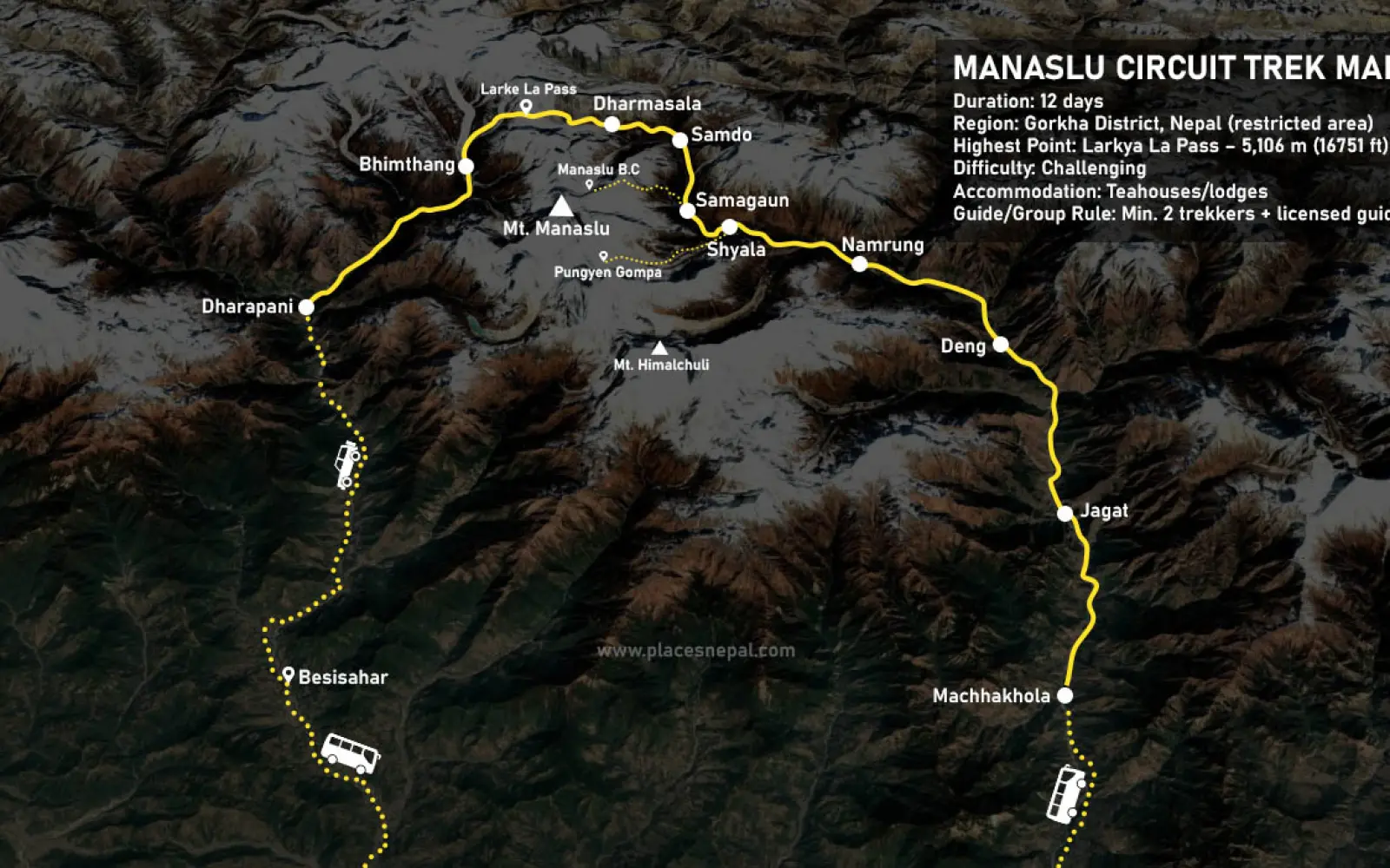
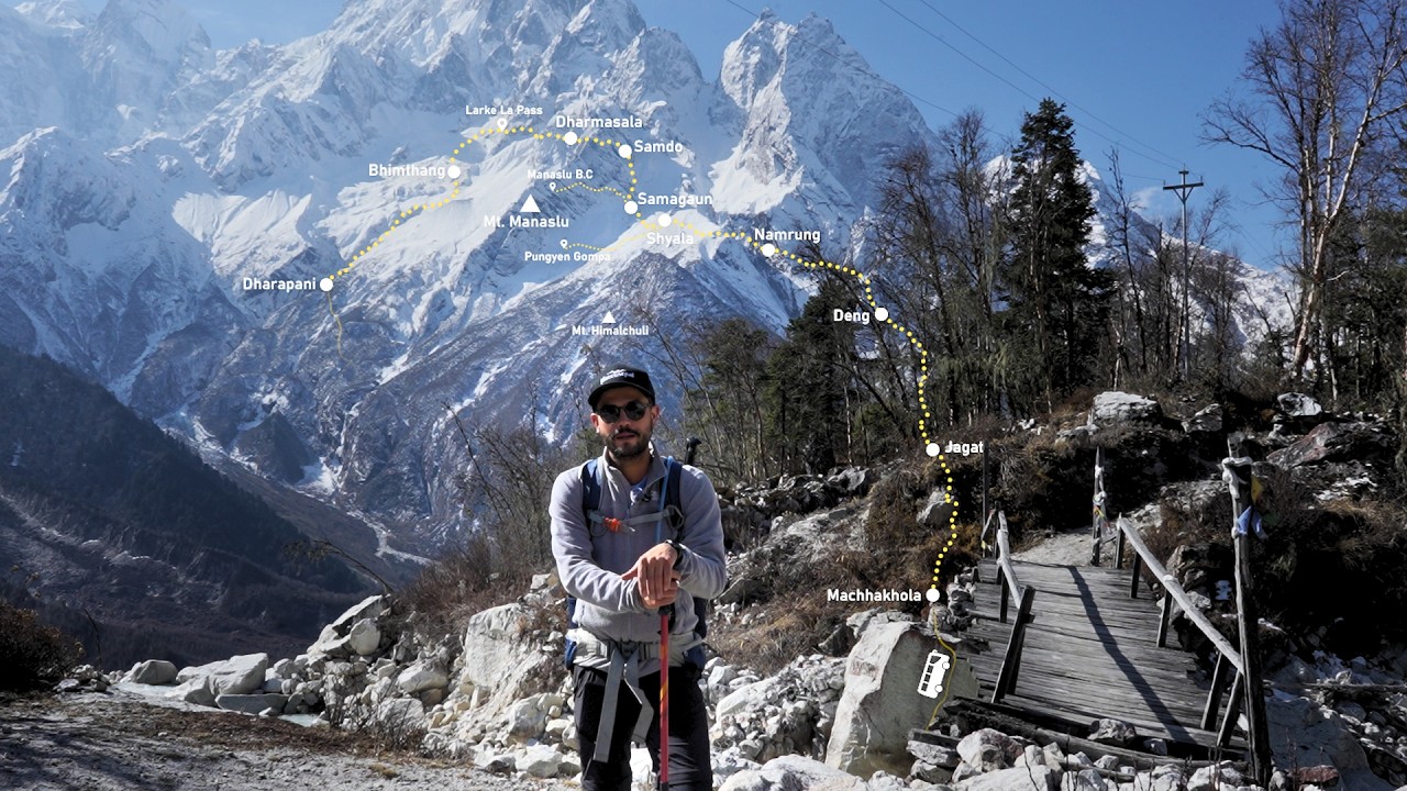
The map above plots the full Manaslu Circuit route from Machha Khola to Dharapani, including every overnight village, Larke Pass, and the main side trips. A few ways to get the most out of it as you read the rest of this guide:
- Zoom in on any village marker to see its name and position relative to the Budhi Gandaki River — most of the lower route simply follows the river upstream, so the gorge itself is your best orientation point.
- Use the full-screen version (link above) when you want to trace a full day's walk without the smaller embedded frame cutting off the view.
- Toggle the data layers using the panel in the corner to separate the trekking trail from the road sections and side trips like Manaslu Base Camp.
- Cross-reference it with the elevation table further down this page — the map shows you where the trail goes, and the tables show you how steep it gets between any two points.
We'll refer back to this map throughout the guide, so keep it open in another tab as you read.
Quick Answer: Where Does the Manaslu Circuit Trek Go?
The Manaslu Circuit Trek runs in a rough horseshoe around the north, west, and south flanks of Mt. Manaslu (8,163 m), Nepal's Gorkha district, close to the Tibetan border.
- Starting point: Machha Khola (890 m), reached by a 7–9 hour road journey from Kathmandu
- Ending point: Dharapani (1,910 m), from where a road connects back to Kathmandu via Besisahar
- Total distance: Roughly 160 km (100 miles) trekking, plus the road transfers on either end
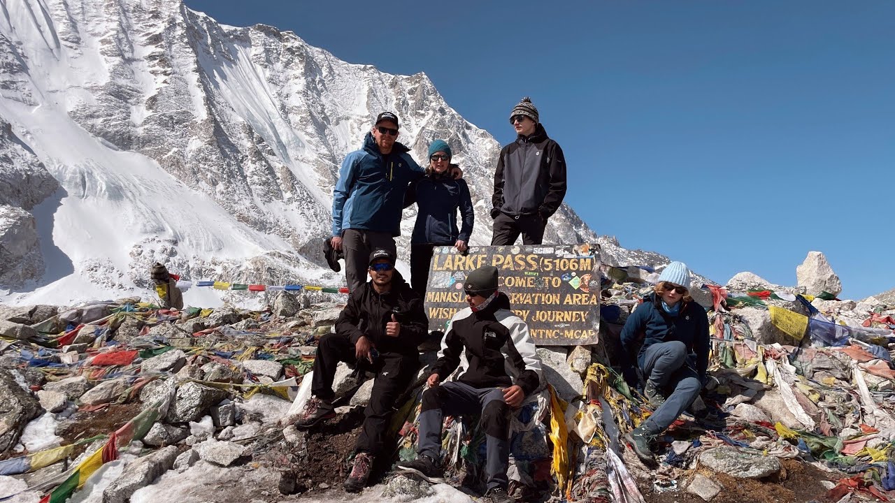
- Highest point: Larke Pass (Larkya La), 5,106 m / 16,752 ft
- Standard duration: 12 days door-to-door (2 driving days, 9 trekking days, 1 built-in acclimatization day)
- Trek style: Teahouse trekking — you sleep and eat in local lodges every night, no camping required
- Region: Manaslu Conservation Area and, near the end, the Annapurna Conservation Area
Unlike Everest Base Camp, there's no flight involved — the entire route is accessed by road from Kathmandu, which is one reason it appeals to trekkers who want the high-mountain experience without the Lukla flight gamble.
Trek the Manaslu Circuit Trek
A remote and off-the-beaten-path Himalayan adventure in Nepal. The trek covers roughly 126 km (78.2 miles) and involves 5–7 hours of hiking per day through villages, forests, and the Larkya Pass
Manaslu Circuit Route Overview
The route follows the Budhi Gandaki River almost the entire way up, which makes the Manaslu Circuit map easier to read than it first looks — you're essentially walking upstream along one river valley until Samdo, crossing Larke Pass into a different watershed, then descending the Dudh Khola valley back down to the Marsyangdi valley near Dharapani.
Broadly, the route breaks into four stages:
- The gorge (Machha Khola → Namrung): Subtropical forest, river crossings, and Gurung villages, climbing from 890 m to 2,630 m.
- The Nubri Valley (Namrung → Samdo): Where Tibetan Buddhist culture takes over — monasteries, mani walls, and your first full views of Manaslu, climbing to 3,875 m.
- The high pass (Samdo → Bimthang): Barren alpine terrain, the Larke Pass crossing at 5,106 m, and a dramatic descent into a green valley on the other side.
- The return (Bimthang → Dharapani): Rhododendron forest and Gurung farmland dropping back to 1,910 m, where the restricted area ends.
Route Summary Table
| Stage | Key Villages | Elevation Range | District |
|---|
| The gorge | Machha Khola, Jagat, Deng | 890 m – 1,860 m | Gorkha |
| Nubri Valley | Namrung, Lho, Shyala, Samagaun, Samdo | 2,630 m – 3,875 m | Gorkha |
| High pass | Dharamsala (Larke Phedi), Larke Pass, Bimthang | 3,728 m – 5,106 m | Gorkha |
| Return valley | Dharapani | 1,910 m | Lamjung |
Manaslu Circuit Trek Route Map Explained
Reading the embedded map correctly makes the rest of your planning much easier, so here's what each element on it actually represents.
The road sections. At the very start and end of the route, the thicker lines represent the drivable road — Kathmandu to Machha Khola on Day 1, and Dharapani back through Besisahar to Kathmandu on the final day. Everything in between is trail only; no vehicles, no shortcuts.
The trekking trail. The main route line follows the Budhi Gandaki gorge almost the whole way to Samdo. It's a single trail with no major route-finding decisions until you're well above Samagaun — you're simply walking up one valley.
River valleys and suspension bridges. The Budhi Gandaki carves the route for the first six days. You'll cross it repeatedly on suspension and cantilever bridges, most of which are marked as waypoints on the map — useful for pacing yourself between villages, since bridges are natural rest points.
Forest zones. The map's lower sections (Machha Khola to Namrung) pass through subtropical forest, then bamboo, then rhododendron and pine as elevation increases — the vegetation you see on the map roughly tracks the elevation contour.
Alpine terrain. Past Samagaun, the trail leaves the treeline behind. On the map this is the open, wide valley section around Samagaun, Samdo, and Dharamsala, where there's little vegetation and the peaks close in from every direction.
The high pass. Larke Pass sits at the narrowest, highest point of the map, connecting the Budhi Gandaki watershed to the Dudh Khola valley on the Bimthang side. It's the one section of the route where weather and timing matter — more on that below.
Trek the Manaslu Circuit Trek
A remote and off-the-beaten-path Himalayan adventure in Nepal. The trek covers roughly 126 km (78.2 miles) and involves 5–7 hours of hiking per day through villages, forests, and the Larkya Pass
Village-by-Village Route Guide
This table covers every overnight stop on the standard Manaslu Circuit itinerary, in the order you'll walk through them.
| Village | Elevation | Distance from Previous | Walking Hours | Accommodation | Highlights |
|---|
| Machha Khola | 890 m / 2,920 ft | 160 km by road from Kathmandu | 7–9 hrs (drive) | 20+ teahouses | First night on trail; Budhi Gandaki riverside village |
| Jagat | 1,340 m / 4,396 ft | 14 km / 8.6 mi | 6–7 hrs | 10–12 teahouses | First permit checkpoint; stone-paved Gurung village |
| Deng | 1,860 m / 6,102 ft | 19.9 km / 12.3 mi | 5–6 hrs | 4–5 basic teahouses | Tibetan-origin village; Tsum Valley trail junction en route |
| Namrung | 2,630 m / 8,629 ft | 20 km / 12 mi | 5–6 hrs | 15+ teahouses | First major cultural landmark; working gompa |
| Shyala | 3,500 m / 11,483 ft | 10 km / 6 mi | 5 hrs | 10+ teahouses & homestays | First full view of Manaslu (via Lho village en route) |
| Samagaun | 3,530 m / 11,581 ft | 10 km / 6.2 mi | 5–6 hrs | 15–20 teahouses | Largest upper-circuit village; 2-night acclimatization stop |
| Samdo | 3,875 m / 12,713 ft | 8.2 km / 5 mi | 3–4 hrs | 6–7 teahouses | Last permanent village before the pass; near Tibet border |
| Dharamsala (Larke Phedi) | 4,460 m / 14,633 ft | 6.1 km / 3.7 mi | 4–5 hrs | 3 basic lodges | High camp for the Larke Pass crossing |
| Bimthang | 3,728 m / 12,231 ft | 17 km / 10.6 mi (via the pass) | 8–10 hrs | Several teahouses | First stop after crossing Larke Pass; green valley views |
| Dharapani | 1,910 m / 6,266 ft | 21 km / 13 mi | 7 hrs | Teahouses & lodges | Final permit checkpoint; road access resumes |
A couple of route variants worth knowing: some multi-day itineraries begin trekking a stage earlier at Soti Khola, a village south of Machha Khola, adding an extra walking day. Places Nepal's standard 12-day itinerary drives directly to Machha Khola on Day 1, covering the same ground by road and giving you an extra day on the higher, more scenic sections instead.
Lho deserves a mention even though it isn't an overnight stop on the standard itinerary — it's the village between Namrung and Shyala where Manaslu comes into full view for the first time, and most itineraries build in a proper stop there.
Manaslu Circuit Elevation Map & Altitude Profile
Altitude, not distance, is what makes the Manaslu Circuit demanding. You gain roughly 4,200 m of net elevation between Machha Khola and Larke Pass, and the pace of that gain is deliberately uneven — steep in places, flat in others — to give your body time to adjust.
| Location | Altitude | Net Gain from Previous Stop | Day |
|---|
| Kathmandu | 1,350 m / 4,429 ft | — | Start |
| Machha Khola | 890 m / 2,920 ft | −460 m (road descent) | Day 1 |
| Jagat | 1,340 m / 4,396 ft | +450 m | Day 2 |
| Deng | 1,860 m / 6,102 ft | +520 m | Day 3 |
| Namrung | 2,630 m / 8,629 ft | +770 m | Day 4 |
| Shyala | 3,500 m / 11,483 ft | +870 m | Day 5 |
| Samagaun | 3,530 m / 11,581 ft | +30 m | Day 6 |
| Samagaun (rest) | 3,530 m / 11,581 ft | 0 m (optional hike to 4,800 m) | Day 7 |
| Samdo | 3,875 m / 12,713 ft | +345 m | Day 8 |
| Dharamsala | 4,460 m / 14,633 ft | +585 m | Day 9 |
| Larke Pass (highest point) | 5,106 m / 16,752 ft | +646 m | Day 10 |
| Bimthang | 3,728 m / 12,231 ft | −1,378 m (same day) | Day 10 |
| Dharapani | 1,910 m / 6,266 ft | −1,818 m | Day 11 |
Two things stand out on this profile. First, the single biggest one-day altitude swing on the entire circuit happens on pass day — you climb 646 m to the summit before dropping 1,378 m to Bimthang, all within about 8–10 hours. Second, the acclimatization built into Day 7 at Samagaun (3,530 m) exists specifically because it's your last real rest before three consecutive nights of pushing higher toward the pass. For a full breakdown of how altitude sickness risk builds through the trek and how to manage it, see our Manaslu Circuit Trek difficulty and altitude guide.
If you're experiencing symptoms of altitude sickness while trekking — persistent headache, nausea, dizziness, or confusion that doesn't improve with rest — descend and seek help immediately rather than pushing on; this is a general safety note, not a substitute for guidance from your guide or a medical professional on the trail.
Trek the Manaslu Circuit Trek
A remote and off-the-beaten-path Himalayan adventure in Nepal. The trek covers roughly 126 km (78.2 miles) and involves 5–7 hours of hiking per day through villages, forests, and the Larkya Pass
Daily Trekking Map: Day-by-Day Route Breakdown
| Day | Route | Distance | Walking Time | Elevation Change | Key Landmarks |
|---|
| 1 | Kathmandu → Machha Khola | 160 km (road) | 7–9 hrs | 1,350 m → 890 m | Budhi Gandaki gorge road |
| 2 | Machha Khola → Jagat | 14 km | 6–7 hrs | 890 m → 1,340 m | Tatopani hot springs, first checkpoint |
| 3 | Jagat → Deng | 19.9 km | 5–6 hrs | 1,340 m → 1,860 m | Philim checkpoint, Tsum Valley junction |
| 4 | Deng → Namrung | 20 km | 5–6 hrs | 1,860 m → 2,630 m | Ghap landslide zone, mani walls |
| 5 | Namrung → Shyala | 10 km | 5 hrs | 2,630 m → 3,500 m | Lho monastery, first Manaslu view |
| 6 | Shyala → Samagaun | 10 km | 5–6 hrs | 3,500 m → 3,530 m | Optional Pungyen Gompa detour (4,040 m) |
| 7 | Samagaun (acclimatization) | 3–15 km round trip | 2–8 hrs | Up to 4,800 m and back | Manaslu Base Camp or Birendra Lake |
| 8 | Samagaun → Samdo | 8.2 km | 3–4 hrs | 3,530 m → 3,875 m | White Kani archway, yak pastures |
| 9 | Samdo → Dharamsala | 6.1 km | 4–5 hrs | 3,875 m → 4,460 m | Glacial meltwater crossing |
| 10 | Dharamsala → Larke Pass → Bimthang | 17 km | 8–10 hrs | 4,460 m → 5,106 m → 3,728 m | Pass summit, Ponkar Lake |
| 11 | Bimthang → Dharapani | 21 km | 7 hrs | 3,728 m → 1,910 m | Final checkpoint, road access |
| 12 | Dharapani → Kathmandu | 230 km (road) | 9–10 hrs | 1,910 m → 1,350 m | Via Besisahar |
For a fuller narrative walkthrough of what each day actually feels like on the trail — meals, teahouse conditions, and hour-by-hour detail — see our complete Manaslu Circuit Trek itinerary guide.
Trek the Manaslu Circuit Trek
A remote and off-the-beaten-path Himalayan adventure in Nepal. The trek covers roughly 126 km (78.2 miles) and involves 5–7 hours of hiking per day through villages, forests, and the Larkya Pass
Side Trips Visible on the Map
Three worthwhile detours branch off the main route, all shown on the embedded map as separate markers.
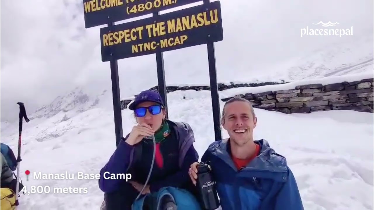
Manaslu Base Camp (4,800 m). The classic Day 7 acclimatization hike from Samagaun — 14–15 km round trip, 6–8 hours, with roughly 1,270 m of climbing. The trail follows the Manaslu Glacier past Birendra Lake to a high glacial shelf directly beneath the mountain's north face. It's strenuous at altitude, so it's the right choice only if you're feeling strong; do it if you woke up with no headache and a full appetite, skip it otherwise.
Pungyen Gompa (4,040 m). An optional detour on Day 6, roughly an hour north of Shyala, adding about 470 m of climbing and 2–3 hours round trip. This is one of the oldest active monasteries in the Manaslu region, set in a quiet alpine meadow above the glacier with an unobstructed view of Manaslu's north face. Worth it if your acclimatization is on track; skip it if you're not feeling 100%, since a full acclimatization day follows tomorrow regardless.
Birendra Lake / Birendra Tal (3,450 m). The easy alternative to Manaslu Base Camp — a 30–45 minute walk each way to a glacial lake just below Samagaun, with minimal elevation change. This is the better choice if you slept poorly or have a mild headache; gentle movement at altitude still counts as acclimatization.
Terrain Along the Manaslu Circuit Route
The terrain shifts more dramatically on this trek than on almost any other route in Nepal, and the map's elevation gradient tells that story clearly.
- Machha Khola to Jagat: Dense subtropical forest along the Budhi Gandaki, with langurs and monkeys a common early-morning sighting.
- Jagat to Namrung: The gorge narrows, cliff faces close in, and forest transitions from bamboo to rhododendron and pine as Tibetan cultural influence starts appearing in the villages.
- Namrung to Samagaun: The valley opens into a genuine alpine landscape — treeline disappears, and Himal Chuli, Ngadi Chuli, and Manaslu itself dominate the skyline.
- Samagaun to Dharamsala: Barren, high-altitude terrain with yak pastures, glacial streams, and increasingly sparse vegetation.
- Larke Pass: Snow and ice year-round on the upper approach, with glacial moraine on the descent toward Bimthang.
- Bimthang to Dharapani: A sharp reversal — rhododendron and oak forest, then terraced Gurung farmland, as the route drops back toward the Marsyangdi valley.
Manaslu Circuit Trek Transportation Map
Kathmandu → Machha Khola: A 7–9 hour road journey covering roughly 160 km. The road is paved as far as Arughat, after which it becomes an unpaved, occasionally dusty mountain road for the final stretch into the Budhi Gandaki gorge. Places Nepal runs this as an included tourist bus departing Gongabu Bus Park between 6:00–8:00 AM, with a private jeep upgrade available for groups wanting more flexibility.
Dharapani → Kathmandu: The return leg splits into two stages — a roughly 3-hour local jeep from Dharapani to Besisahar, followed by a 6–7 hour drive on to Kathmandu. Trekkers with extra time sometimes break this into a Pokhara stopover instead of heading straight back.
Neither leg involves a domestic flight, which is one of the practical advantages of the Manaslu Circuit over routes like Everest Base Camp that depend on the Lukla airstrip.
Offline Navigation & GPS Apps for the Manaslu Circuit
Mobile signal is unreliable for most of the route and disappears almost entirely above Samagaun, and Wi-Fi in teahouses becomes patchy above roughly 3,500 m. That makes offline navigation useful — not as a replacement for your guide, but as a way to track your own progress and reassure yourself of where you are.
- Organic Maps — free, open-source, and works well offline across Nepal; a solid default choice.
- Maps.me — one of the most widely used offline map apps among Nepal trekkers, with the Manaslu trail already mapped by previous users.
- Gaia GPS — stronger for topographic detail and elevation profiles if you want to track your daily climb in real time.
- GPX files — downloadable route files (including from the embedded map above via its data layers) that you can load into any of the apps above before you leave Kathmandu, while you still have reliable Wi-Fi.
A genuine caution here: the Manaslu region is a restricted area, and a licensed guide is legally required regardless of how good your offline maps are. GPS apps are a useful supplement for orientation and peace of mind — they are not a substitute for the guide and permits the law requires, and they won't help you navigate a whiteout on Larke Pass the way local experience will.
Is the Manaslu Circuit Trail Easy to Follow?
Compared with Everest Base Camp or the Annapurna Circuit, the Manaslu Circuit trail is less signposted and more remote — one reason the Nepal government classifies it as a restricted area rather than an open trekking route.
- Trail markings: Cairns and prayer flags mark the route above the treeline, particularly on the approach to Larke Pass, but formal signage is minimal compared with more developed trekking regions.
- Guide requirement: A licensed guide from a registered trekking agency is mandatory for every foreign trekker on this route — this is a legal requirement, not just a safety recommendation.
- Solo trekking rule (2026 update): As of March 22, 2026, Nepal's Department of Immigration removed the long-standing requirement that solo trekkers find a second person to obtain a Manaslu Restricted Area Permit. Solo travelers can now apply individually — but the licensed guide requirement has not changed and remains mandatory. Always confirm current rules with your trekking agency or the Nepal Tourism Board before departure, since permit regulations are subject to change.
- Checkpoints: Permits are checked at Jagat (the entry to the restricted area), Philim, and again at Dharapani, where the restricted zone ends.
- Navigation challenges: The biggest risk isn't getting lost on a clear day — it's poor visibility near Larke Pass, where snow can obscure the trail and cairns entirely. This is precisely why the guide requirement exists.
Route Variations on the Manaslu Circuit
The standard route isn't the only way to walk this circuit. A few real variations worth considering, depending on your time and appetite for altitude:
- Standard 12-day circuit — the itinerary detailed throughout this guide; the most efficient way to complete the full circuit with one built-in acclimatization day.
- Short Manaslu Circuit Trek (10 days) — a compressed version for trekkers with tighter schedules, cutting travel buffer without skipping the pass.
- Tsum Valley with Manaslu Circuit Trek (17 days) — adds the sacred, even more remote Tsum Valley via the trail junction near Deng before rejoining the main circuit.
- Manaslu and Annapurna Circuit Trek (20 days) — continues past Dharapani onto the Annapurna Circuit for trekkers who want two of Nepal's best circuits back to back.
- Tibet Border Manaslu Circuit Trek (13 days) — a variant with extra time near Samdo, close to the Tibetan frontier.
The trade-off is straightforward: shorter itineraries save time and money but leave less buffer for weather delays near the pass; longer combined routes cost more days but deliver considerably more remote terrain and cultural depth.
Best Viewpoints Along the Manaslu Circuit Route
| Location | Elevation | What You'll See |
|---|
| Lho | 3,180 m (approx.) | First full, unobstructed view of Manaslu's south face |
| Shyala | 3,500 m | 360-degree glacial valley panorama — Himal Chuli, Ngadi Chuli, Baudha Himal |
| Samagaun / Ribung Gompa | 3,530 m | Manaslu's north face at close range, especially in late afternoon light |
| Birendra Lake | 3,450 m | Turquoise glacial lake directly beneath the Manaslu massif |
| Pungyen Gompa | 4,040 m | Manaslu Glacier and north face from a quiet monastery meadow |
| Larke Pass summit | 5,106 m | 360-degree panorama: Manaslu, Himlung Himal, Kang Guru, Annapurna II |
| Bimthang | 3,728 m | Manaslu and Ganesh Himal framing a green valley after the pass |
Other Himalayan Trek Routes to Explore
The Manaslu Circuit isn't the only way to experience Nepal's high Himalaya, and if you're still weighing your options, it helps to see how it compares against the country's other classic routes. Each of the treks below takes you into different terrain and culture, so the right choice comes down to what you value most — solitude, iconic scenery, cultural depth, or logistics that fit a shorter trip.
The Manaslu Circuit Trek remains one of Nepal's best remote circuit treks precisely because it's still a restricted area — fewer trekkers, more intact Tibetan Buddhist culture, and a genuine high pass crossing without the crowds you'll find further east. The Everest Base Camp Trek is the route to choose if iconic Himalayan scenery and Sherpa culture matter more to you than solitude — you'll stand beneath the world's highest mountain and walk through the most developed trekking infrastructure in Nepal. The Annapurna Circuit is the better fit for travelers who want a classic circuit trek with more teahouse options and easier logistics, while still crossing a serious high pass at Thorong La. Upper Mustang suits trekkers drawn to desert landscapes and Tibetan culture rather than glaciers and forest — it's a different kind of Himalayan trek entirely, arid and culturally distinct. And the Langtang Valley Trek is worth considering if your timeline is tight but you still want serious mountain scenery in under two weeks.
| Trek | Route Style | Maximum Altitude | Best For | Why Choose It |
|---|
| Manaslu Circuit Trek | Restricted-area circuit | 5,106 m (Larke Pass) | Solitude, culture, remote wilderness | Fewer trekkers, intact Tibetan Buddhist villages |
| Everest Base Camp Trek | Out-and-back | 5,644 m (Kala Patthar viewpoint) | Iconic scenery, Sherpa culture | The most famous mountain view in the world |
| Annapurna Circuit Trek | Classic circuit | 5,416 m (Thorong La) | Variety, comfort, flexibility | More developed infrastructure, easier logistics |
| Upper Mustang Trek | Rain-shadow plateau | 3,840 m (Lo Manthang) | Desert landscapes, Tibetan culture | A completely different Himalayan environment |
| Langtang Valley Trek | Out-and-back valley | 3,870 m (Kyanjin Ri optional higher) | Shorter timelines, big mountain views | Serious scenery achievable in under two weeks |
Trek the Manaslu Circuit Trek
A remote and off-the-beaten-path Himalayan adventure in Nepal. The trek covers roughly 126 km (78.2 miles) and involves 5–7 hours of hiking per day through villages, forests, and the Larkya Pass
Expert Route Planning Tips
- Download your offline map app and the GPX route before leaving Kathmandu, while you still have reliable Wi-Fi.
- Save your guide's number and your agency's emergency contact in your phone before you lose signal.
- Study the daily elevation gain table above so you know which days are demanding versus easy.
- Identify the acclimatization stops in advance (Day 7 at Samagaun is non-negotiable) and mentally commit to them.
- Keep your phone and camera battery charged at every opportunity below 3,500 m — charging becomes unreliable above that point.
- Carry a paper copy of your itinerary and permit details as a backup to digital copies.
- Pack a physical trekking map or guidebook alongside your phone apps — batteries fail, paper doesn't.
- Build in 1–2 buffer days for weather, especially around the Larke Pass crossing.
- Start each day's walk early — afternoon cloud and wind build up quickly above 3,500 m.
- Cross the icy stream before Dharamsala carefully; wet boots at 4,400 m+ are a real problem heading into pass day.
- Fit crampons and warm layers before leaving the lodge on pass day — there's no stopping to re-kit in the dark.
- Don't linger at the summit of Larke Pass; take your photos, then start the descent while your body is still warm.
- Use trekking poles actively on both the Larke Pass descent and the long drop into Dharapani — your knees will thank you.
- Confirm your Dharamsala teahouse booking a day in advance during peak season; the three lodges there fill up fast.
- Check the current permit rules with your our team before departure — Manaslu's regulations changed as recently as March 2026.
- Book your trekking agency and permits at least 3 weeks in advance; last-minute restricted-area permits risk delays.
- Choose autumn (September–November) or spring (March–May) for the most reliable weather on the pass.
- Pack for both seasons even in spring — snowstorms can occur on Larke Pass regardless of the month.
- Bring more cash than you think you need; there are no ATMs beyond Arughat.
- Treat all drinking water — tap water is untreated at every elevation on this route.
- Eat a full dinner even when altitude suppresses your appetite — your body needs the calories more than ever.
- Pass all mani walls, chortens, and prayer wheels on your left, moving clockwise, as Tibetan Buddhist custom asks.
- Ask before photographing people, gompa interiors, or religious ceremonies along the route.
- Layer up the moment you stop moving at altitude — wind chill drops fast once you're not generating body heat.
- Use the Samagaun rest day honestly — choose Birendra Lake over Manaslu Base Camp if you're not feeling 100%.
- Time your Larke Pass crossing for a pre-dawn start (typically 3:00 AM) to cross before afternoon weather builds.
- Bring a headlamp with fresh batteries — the pass-day departure happens entirely in darkness.
- Keep a physical or photographed copy of your permits separate from your guide's originals, in case of loss.
- Track your own pace against the walking-hour estimates in this guide rather than comparing yourself to faster trekkers.
- Report any AMS symptoms to your guide immediately rather than waiting to see if they pass on their own.
Common Route Planning Mistakes
- Underestimating daily distances. A 20 km day at 2,000 m feels very different from the same distance at sea level; budget more time than a flat-ground pace suggests.
- Ignoring altitude gain in favor of distance. Day 8 (8.2 km) is easier than Day 5 (10 km) purely because of the elevation gain involved — plan around gain, not just kilometers.
- Relying only on mobile signal for navigation or safety. Signal disappears above Samagaun; offline maps and your guide are what actually get you through.
- Skipping the Samagaun acclimatization day. It's built into the itinerary for a physiological reason, not as a scenic bonus day.
- Confusing road sections with trekking sections when reading trip summaries. Day 1 and Day 12 are road transfers, not trekking days — don't count them toward your fitness expectations.
- Assuming you can trek without a guide. This is a restricted area; independent trekking is not legally permitted regardless of experience level.
- Booking permits too close to departure. Restricted-area permits can take several days to process and aren't issued on weekends or public holidays.
- Packing for one season only. Weather at 5,106 m can turn regardless of the calendar month.
- Underestimating the descent from Larke Pass to Bimthang. A 1,378 m drop in a single afternoon is harder on the knees than most trekkers expect.
- Not budgeting extra days for the pass crossing. A tight itinerary with zero buffer leaves no room for a weather delay at Dharamsala.
- Choosing Manaslu Base Camp over Birendra Lake despite feeling unwell. Ambition on the acclimatization day is exactly the wrong instinct if your body is signaling otherwise.
- Assuming Wi-Fi will work above Samagaun. It's unreliable at best from Samdo onward — don't plan on staying connected.
- Not charging devices at every opportunity below 3,500 m. Charging becomes scarce and sometimes fee-based above that point.
- Overlooking the Tsum Valley junction near Deng. Trekkers combining routes occasionally miss the split; confirm the correct trail with your guide.
- Bringing too little cash. ATMs disappear beyond Arughat, and teahouses along the upper route are cash-only.
- Ignoring the Ghap landslide zone's terrain warnings. This section demands single-file walking and full attention, not a place to rush.
- Removing crampons too early on the pass descent. Most falls on Larke Pass happen when trekkers de-kit before the terrain has actually stabilized.
- Assuming the standard 12-day itinerary and the 14–17 day versions cover identical ground. Longer itineraries usually add Tsum Valley or extra acclimatization, not just padding.
- Not confirming which starting village your itinerary uses. Soti Khola and Machha Khola are different points, and it affects your total walking distance.
- Treating the embedded route map as a substitute for your guide's real-time trail knowledge. The map shows you the shape of the journey; it doesn't replace local judgment on snow conditions, weather, or trail closures.
Trek the Manaslu Circuit Trek
A remote and off-the-beaten-path Himalayan adventure in Nepal. The trek covers roughly 126 km (78.2 miles) and involves 5–7 hours of hiking per day through villages, forests, and the Larkya Pass
Frequently Asked Questions
How long is the Manaslu Circuit Trek? The standard itinerary is 12 days door-to-door, including 2 road-travel days and 9 trekking days, with extended versions running 14–20 days depending on side trips like Tsum Valley.
Where does the Manaslu Circuit Trek start and end? It starts at Machha Khola (890 m), reached by road from Kathmandu, and ends at Dharapani (1,910 m), from where a road connects back to Kathmandu.
How far is the Manaslu Circuit Trek? Roughly 160 km (100 miles) of trekking, not counting the road transfers at either end.
What is the highest point on the Manaslu Circuit? Larke Pass (also called Larkya La), at 5,106 m / 16,752 ft, crossed on Day 10 of the standard itinerary.
Where exactly is Larke Pass? It sits between Dharamsala and Bimthang, connecting the Budhi Gandaki watershed to the Dudh Khola valley on the western side of the circuit.
Is "Larke Pass" the same as "Larkya La"? Yes — you'll see it spelled Larke Pass, Larkya La, Larkya Pass, and Larke La across different sources; they all refer to the same 5,106 m crossing.
Can I use Google Maps on the Manaslu Circuit? Google Maps works in areas with signal but has limited trail-level detail for this region and no offline mode reliable enough on its own; a dedicated offline trekking app is a better primary tool.
Which offline map app is best for the Manaslu Circuit? Organic Maps and Maps.me are the most commonly used free options; Gaia GPS is a stronger choice if you want detailed elevation tracking.
Is the Manaslu Circuit trail well marked? It's less signposted than Everest Base Camp or the Annapurna Circuit — cairns and prayer flags mark the higher sections, but a licensed guide is legally required and is your primary navigation resource.
Do I need a guide to trek the Manaslu Circuit? Yes. This is a restricted area, and a licensed guide from a registered trekking agency is a legal requirement for every foreign trekker.
Can I trek the Manaslu Circuit solo? As of March 22, 2026, solo trekkers can apply for the Manaslu Restricted Area Permit individually without needing a second person, but a licensed guide remains mandatory regardless of group size.
What permits do I need for the Manaslu Circuit? The Manaslu Restricted Area Permit (MRAP), Manaslu Conservation Area Permit (MCAP), Annapurna Conservation Area Permit (ACAP) near the end of the route, and a Chumnubri Rural Municipality entry fee. See our full Manaslu permits and fees guide for current costs.
Where are the permit checkpoints on the Manaslu Circuit? At Jagat (entry to the restricted area), Philim, and Dharapani (exit, where the restricted zone ends).
Which villages have tea houses on the Manaslu Circuit? Every overnight stop does — Machha Khola, Jagat, Deng, Namrung, Shyala, Samagaun, Samdo, Dharamsala, Bimthang, and Dharapani — though facilities become more basic the higher you go.
How many acclimatization days does the Manaslu Circuit have? One dedicated rest day, at Samagaun (3,530 m) on Day 7, plus the naturally gradual elevation gain built into the earlier days.
Is Larke Pass harder than crossing points on other Nepal treks? At 5,106 m it's lower than Kala Patthar (the highest viewpoint most Everest Base Camp trekkers reach, around 5,644 m) but slightly higher than Everest Base Camp itself (5,364 m), and broadly comparable in difficulty to Thorong La on the Annapurna Circuit (5,416 m).
Can beginners do the Manaslu Circuit Trek? It's rated challenging rather than beginner-friendly, mainly due to altitude and remoteness, but trekkers with reasonable fitness and no prior high-altitude experience complete it successfully every season with a well-paced itinerary.
What is the best season for the Manaslu Circuit? Autumn (September–November) is generally considered the most reliable, with spring (March–May) a strong second choice for rhododendron blooms and clearer high-altitude conditions later in the season.
Does the embedded map show real-time GPS location? No — it's a reference map of the fixed route; use a dedicated GPS app like Organic Maps or Gaia GPS if you want real-time location tracking on the trail.
Can I download the Manaslu Circuit map as a GPX file? Yes — the interactive map above includes data layers you can export before you leave Kathmandu and load into any offline map app.
Is there mobile signal along the Manaslu Circuit? Signal is inconsistent below Samagaun and largely absent from Samdo onward; don't rely on it for navigation or communication above 3,500 m.
Where can I see Manaslu Base Camp on the map? It's marked as a side-trip branch off Samagaun, roughly 7–7.5 km north of the village, reached via Birendra Lake.
What is Pungyen Gompa and where is it? An ancient monastery at 4,040 m, roughly an hour's walk north of Shyala, reached via an optional detour on Day 6.
Where is Birendra Lake located on the route? Just below Samagaun, a 30–45 minute walk each way, and the easier of the two Day 7 acclimatization options.
How many actual trekking days are there, excluding road travel? Nine trekking days plus one acclimatization day, out of the standard 12-day itinerary.
Can the Manaslu Circuit be shortened? Yes — the Short Manaslu Circuit Trek compresses the itinerary to 10 days for trekkers with tighter schedules.
Can the Manaslu Circuit be combined with Tsum Valley? Yes, via a trail junction near Deng — see our Tsum Valley with Manaslu Circuit Trek itinerary.
Can the Manaslu Circuit be combined with the Annapurna Circuit? Yes, by continuing past Dharapani onto the Annapurna trail — see our Manaslu and Annapurna Circuit Trek.
What's the difference between Soti Khola and Machha Khola as starting points? Soti Khola sits slightly south of Machha Khola; some itineraries begin trekking there, adding a day, while Places Nepal's standard itinerary drives directly to Machha Khola and starts walking from there.
How do I get from Dharapani back to Kathmandu? A roughly 3-hour jeep to Besisahar, followed by a 6–7 hour drive to Kathmandu, with an optional stopover in Pokhara.
Is the road from Kathmandu to Machha Khola paved? Only as far as Arughat — the final stretch into the Budhi Gandaki gorge is unpaved and can be dusty or rough, especially after monsoon.
What wildlife might I see along the route? Grey and white-faced langurs in the lower forest sections, yaks in the upper pastures, and occasionally Himalayan tahr near Manaslu Base Camp.
Are there suspension bridges on the Manaslu Circuit? Yes, several, particularly between Machha Khola and Namrung, including wooden and traditional cantilever bridges over the Budhi Gandaki.
Which villages are Tibetan Buddhist versus Gurung? Machha Khola and Jagat are primarily Gurung; Deng onward through Namrung, Shyala, Samagaun, and Samdo is predominantly Tibetan Buddhist; the character shifts back toward Gurung communities after Bimthang, near Dharapani.
Is Wi-Fi available along the trail? Available and fairly reliable up to Samagaun, then increasingly unreliable, and absent altogether at Dharamsala.
What's the difference between the Manaslu Circuit map and the Everest Base Camp map? Manaslu is entirely road- and trail-accessed with no flight involved, follows a single river valley for most of its length, and passes through a restricted area; Everest Base Camp begins with a flight to Lukla and follows a more developed, more heavily trafficked trail network.
Do I need crampons for Larke Pass? Yes, in most seasons — snow and ice are common on the upper approach and descent, and crampons are considered essential rather than optional.
What time should I start the Larke Pass crossing? Typically around 3:00 AM, to reach the summit in the 4–5 hours before afternoon weather and cloud build up over the high terrain.
How accurate is the embedded interactive map? It reflects the standard, current trekking route and village locations; always confirm real-time trail conditions with your guide, since landslides and rerouting occasionally shift small sections after monsoon season.
Can children or seniors do this route? It's possible with the right pacing and a longer, more gradual itinerary, but the altitude and remoteness make it more demanding than family-friendly routes like Ghorepani Poon Hill; talk to your agency about a custom pace if trekking with children or older travelers.
What should I do if I get lost on the trail? Stop, stay where you are, and wait for your guide or group — this is precisely the scenario the mandatory guide requirement exists to prevent, and it's far safer than trying to self-navigate an unfamiliar restricted area.