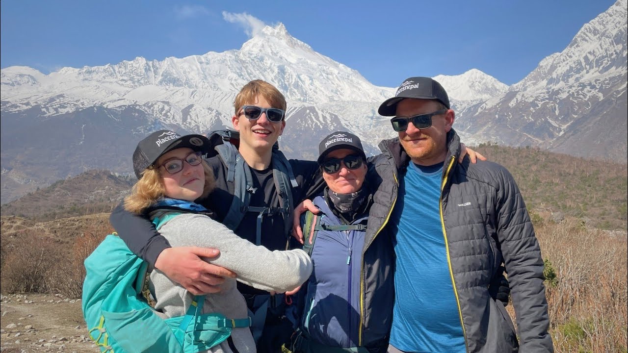
How high do you sleep on the Everest Three Passes Trek, and how do you acclimatize before crossing Kongma La, Cho La and Renjo La? This guide breaks down the night-by-night sleeping altitudes, explains the role of Chhukung Ri and Gokyo Ri, and shows the difference between daytime altitude and where you actually sleep.
The Everest Three Passes Trek is a 17-day high-altitude circuit with nine nights above 4,000 m, one night above 5,000 m, and three pass crossings above 5,300 m. Our current 17-day itinerary manages this through a gradual sleeping-altitude progression, two scheduled acclimatization days built around a "climb high, sleep low" hike, and deliberate spacing between the three hardest days of the route. Nothing about that structure removes the risk of altitude illness — it reduces avoidable altitude stress, which is a different thing.
The lowest sleeping altitude on the route is Phakding at 2,610 m on Day 1. The highest is Gorak Shep at 5,140 m on Day 8. The highest point reached anywhere on the trek is Kala Patthar at 5,545 m on Day 9 — not one of the three passes, and not Everest Base Camp either. The three passes themselves sit close together in elevation: Kongma La at approximately 5,535–5,540 m (Day 7, the highest of the three), Cho La at approximately 5,420 m (Day 10, the most technical), and Renjo La at 5,360 m (Day 13, the most scenic but crossed after the most accumulated fatigue).
This article is not another day-by-day itinerary write-up — for that, see the full 17-day Everest Three Passes Trek itinerary, or, for why the route runs in the direction it does, Everest Three Passes Trek: Clockwise or Anticlockwise. What follows is specifically about altitude: where you sleep, how high you climb during the day, why those two numbers are different, and how Chhukung Ri and Gokyo Ri fit into the acclimatization plan.
Sleeping Altitude vs. Daytime Altitude
This is the distinction that matters most on a route like this one, and it's worth stating plainly before anything else: your body adapts primarily to the altitude where it spends the night, not the highest altitude it touches during the day.
A trekker can climb several hundred meters higher than their overnight elevation, spend an hour or two up there, and descend to sleep lower — and that's a genuinely different physiological event from sleeping at that higher elevation. The Three Passes itinerary uses this distinction deliberately, three separate times:
- Day 3 — hike to Hotel Everest View at 3,880 m, sleep back in Namche at 3,440 m
- Day 9 — climb to Kala Patthar at 5,545 m, but the overnight is at Dzongla, 4,830 m
- Day 12 — hike to Gokyo Ri at 5,357 m, sleep back in Gokyo at 4,750 m
This is the "climb high, sleep low" principle, and it's the reason the itinerary can touch 5,300–5,500 m repeatedly without every one of those touches becoming an overnight exposure at that elevation. It is not a guarantee against altitude illness — it's one part of a broader acclimatization strategy, and individual response to altitude still varies. More on that later in this article.
Three Passes Trek Altitude at a Glance
| Location / Point | Approx. Elevation | Sleeping or Day Point |
|---|
| Lukla | 2,840 m / 9,318 ft | Sleeping (Days 1 & 16) |
| Phakding | 2,610 m / 8,563 ft | Sleeping (Days 1 & 15) |
| Namche Bazaar | 3,440 m / 11,286 ft | Sleeping (Days 2, 3 & 14) |
| Hotel Everest View | 3,880 m / 12,730 ft | Day hike (Day 3) |
| Tengboche | 3,860 m / 12,664 ft | Sleeping (Day 4) |
| Dingboche | 4,410 m / 14,469 ft | Sleeping (Day 5) |
| Chhukung | 4,730 m / 15,518 ft | Sleeping (Day 6) |
| Kongma La | ~5,535–5,540 m / ~18,160–18,180 ft | Pass (Day 7) |
| Lobuche | 4,910 m / 16,109 ft | Sleeping (Day 7) |
| Gorak Shep | 5,140 m / 16,864 ft | Sleeping (Day 8) |
| Everest Base Camp | 5,364 m / 17,598 ft | Day objective (Day 8) |
| Kala Patthar | 5,545 m / 18,192 ft | Day hike / highest point (Day 9) |
| Dzongla | 4,830 m / 15,846 ft | Sleeping (Day 9) |
| Cho La | ~5,420 m / ~17,782 ft | Pass (Day 10) |
| Thagnak | 4,750 m / 15,584 ft | Sleeping (Day 10) |
| Gokyo | 4,750 m / 15,584 ft | Sleeping (Days 11 & 12) |
| Gokyo Ri | 5,357 m / 17,575 ft | Day hike (Day 12) |
| Renjo La | 5,360 m / 17,585 ft | Pass (Day 13) |
| Marulung | 4,210 m / 13,812 ft | Sleeping (Day 13) |
Night-by-Night Sleeping Altitude
This is the table that actually matters for acclimatization — not the highest point touched each day, but where the body actually spends eight hours.
| Day | Overnight | Sleeping Elevation | Change from Previous Night |
|---|
| 1 | Phakding | 2,610 m | — (first night) |
| 2 | Namche Bazaar | 3,440 m | +830 m |
| 3 | Namche Bazaar | 3,440 m | 0 m (acclimatization) |
| 4 | Tengboche | 3,860 m | +420 m |
| 5 | Dingboche | 4,410 m | +550 m |
| 6 | Chhukung | 4,730 m | +320 m |
| 7 | Lobuche | 4,910 m | +180 m |
| 8 | Gorak Shep | 5,140 m | +230 m |
| 9 | Dzongla | 4,830 m | −310 m |
| 10 | Thagnak | 4,750 m | −80 m |
| 11 | Gokyo | 4,750 m | 0 m |
| 12 | Gokyo | 4,750 m | 0 m (acclimatization) |
| 13 | Marulung | 4,210 m | −540 m |
| 14 | Namche Bazaar | 3,440 m | −770 m |
| 15 | Phakding | 2,610 m | −830 m |
| 16 | Lukla | 2,840 m | +230 m |
Day 17 is a flight day back to Kathmandu (approx. 1,400 m) with no mountain overnight. Two things stand out in this table that a simple summit-elevation list would hide completely: the sleeping altitude never rises by more than 830 m between consecutive nights, and it actually decreases three separate times in the second half of the trek — after Kala Patthar (Day 9), after Renjo La (Day 13), and through the two-day descent to Namche (Day 14–15) — well before the trek is over. Recovery is built into the schedule, not left to chance.
Why Sleeping Altitude Matters More Than Maximum Altitude
The body's acclimatization response is driven substantially by the elevation at which it rests for extended periods — overnight in particular, when breathing rate naturally drops and the drive to compensate for lower oxygen has to come from physiological adaptation rather than simply working harder. A short excursion to a higher elevation, followed by a return to a lower one before sleep, is a materially different exposure than spending the night at that higher point.
This is why Gorak Shep, at 5,140 m, is described on Places Nepal's own product page as "the highest sleeping altitude of the trek" — not Kala Patthar at 5,545 m, not Everest Base Camp at 5,364 m, and not any of the three passes. All of those are touched only during the day. The itinerary treats the Gorak Shep night with particular caution for exactly this reason: it's the single hardest sleeping exposure on the whole 17-day route.
None of this should be read as a guarantee. The relationship between sleeping altitude and acclimatization outcome is well documented in altitude medicine, but individual physiological response to altitude varies significantly and cannot be predicted from fitness level, age, or previous trekking experience alone.
How the 17-Day Itinerary Builds Acclimatization
Zoom out from the day-by-day numbers and a clear structure emerges. It isn't one rest day doing all the work — it's four separate mechanisms working together across the full 17 days.
Gradual sleeping-altitude increase through the lower Khumbu. The first six nights — Phakding, Namche (twice), Tengboche, Dingboche, Chhukung — climb from 2,610 m to 4,730 m in stages, none larger than 830 m, before the itinerary allows any night above 5,000 m.
Two scheduled acclimatization days, both active rather than passive. Namche on Day 3 and Gokyo on Day 12 are the only two days on the entire itinerary without net upward trekking progress — and both are built around a climb-high, sleep-low hike (Hotel Everest View, then Gokyo Ri) rather than simple rest.
Short positioning days placed directly before the hardest days. Day 6, Dingboche to Chhukung, covers only 5 km in 2–3 hours — a deliberately easy day positioned the afternoon before Kongma La. Day 11, Thagnak to Gokyo, plays the same role after Cho La and before the Gokyo Ri acclimatization day.
Deliberate spacing between the three passes. Kongma La (Day 7), Cho La (Day 10), and Renjo La (Day 13) are not back-to-back. Three days separate the first two; two days separate the second and third — giving the body recovery time between the itinerary's three most demanding single days, rather than stacking them consecutively.
This structure explains why the Three Passes Trek's difficulty rating comes from more than just "three passes above 5,300 m." It's the combination of route, altitude, and pacing together.
Namche Acclimatization: Why Day 3 Matters
Namche Bazaar sits at 3,440 m and hosts two nights on the way up (Days 2 and 3) — the first scheduled acclimatization stop on the route, and one of only two on the whole itinerary. The morning of Day 3 typically includes a hike to Hotel Everest View at 3,880 m, the highest constructed hotel in the world and a genuine viewpoint for Everest, Lhotse, Nuptse, and Ama Dablam. The group then returns to sleep at Namche's 3,440 m.
This is a textbook climb-high, sleep-low day: roughly 440 m of daytime elevation gain, none of it carried into the overnight elevation. It's positioned early in the trek deliberately — before the route has reached altitudes where a missed acclimatization day carries serious consequences, but late enough that the body has already had two nights above 3,000 m to begin adjusting.
Skipping or shortening this day is a genuinely bad idea on a route that goes on to reach above 5,300 m three separate times. It isn't presented as optional on Places Nepal's current itinerary.
Dingboche and Chhukung: Where Altitude Becomes a Daily Factor
After Tengboche (3,860 m), the route crosses a threshold most trekkers notice immediately. Dingboche, at 4,410 m, sits above the treeline in open glacial moraine — this is where altitude stops being a background consideration and becomes something addressed at every meal and every rest stop.
Chhukung, one short day later at 4,730 m, pushes further still. The distance from Dingboche to Chhukung is only 5 km, covered in 2–3 hours — a deliberately light day, positioned specifically because tomorrow (Kongma La) is one of the hardest days of the entire trek. Not every trekker experiences symptoms at this stage, and mild effects — a duller appetite, slightly disrupted sleep — are common rather than alarming. But this is the point in the route where those effects, if they appear, tend to start.
Chhukung Ri: An Optional Hike, Not Part of the Standard Itinerary
Chhukung Ri is a well-known viewpoint above Chhukung village — a straightforward but strenuous half-day hike to approximately 5,546 m, offering close-range views of Island Peak, Lhotse Shar, and the Chhukung Glacier before Kongma La the following day.
Chhukung Ri is not part of our standard 17-day Everest Three Passes Trek itinerary. We keep the afternoon in Chhukung relatively easy so you can rest and prepare for the Kongma La crossing.
However, if you are feeling strong and well-acclimatized that day, you can discuss hiking Chhukung Ri with your guide. It can be a useful extra acclimatization hike, but it is not something you need to force yourself to do.
Our advice: decide on the day. Your guide will assess how you are feeling, the weather and trail conditions, and you can choose whether to hike Chhukung Ri or take the afternoon to rest. There is no benefit in pushing for the summit if your body is telling you to recover.
Chhukung Ri vs. Kongma La
These two are sometimes confused by first-time researchers, but they serve entirely different functions:
| Chhukung Ri | Kongma La |
|---|
| Role | Optional acclimatization day hike | Mandatory pass crossing (Day 7) |
| Approx. elevation | ~5,546 m | ~5,535–5,540 m |
| Overnight after | Returns to sleep at Chhukung (4,730 m) | Continues over the pass to sleep at Lobuche (4,910 m) |
| Distance/effort | Half-day round trip from Chhukung | Full-day crossing, 11 km, 7–9 hrs |
| Standard on Places Nepal's itinerary | No — private/custom option | Yes — every 17-day departure |
The two are not interchangeable. One is an optional acclimatization exercise you return from; the other is a required, one-way crossing that takes you onward to the next valley.
The First 5,000+ Meter Day: Kongma La
By the time the route reaches Kongma La on Day 7, the trekker has already spent six nights climbing gradually from 2,610 m to 4,730 m — the entire lower-Khumbu progression described above. Kongma La is the first point on the itinerary that pushes above 5,000 m, and it does so decisively: from Chhukung at 4,730 m, the climb gains over 800 m to the pass summit at approximately 5,535–5,540 m, the highest of the three passes.
Kongma La: What the Altitude Does to the Crossing
Kongma La's difficulty comes from a combination of elevation, distance, and terrain rather than technical climbing. The ascent from Chhukung is steep, rocky, and non-glaciated — demanding on the legs and lungs rather than requiring rope work or crampons under normal conditions. At the altitude involved, oxygen availability is roughly half of what it is at sea level, which slows pace regardless of fitness level; the descent onto the lateral moraine of the Khumbu Glacier that follows is loose and physically taxing in its own right, arguably harder on tired legs than the ascent. Weather at this elevation can shift quickly, and guides make real-time calls on pacing and, where necessary, turning back. For the full route mechanics, terrain, and preparation detail, see the Kongma La Pass guide, and for pass-day kit — warm layers, traction devices, and what actually earns a place in your pack — see the Everest Three Passes Trek packing list.
Gorak Shep and Everest Base Camp: Sleeping Low, Visiting High
Day 8 is the day most trekkers picture when they imagine this trek, and it's also a clean illustration of the sleeping-vs-daytime-altitude distinction. The overnight stop is Gorak Shep, at 5,140 m — a flat, sandy former lakebed and the highest sleeping altitude anywhere on the route. From there, the round trip to Everest Base Camp at 5,364 m and back is a same-day excursion: the group drops packs at Gorak Shep, walks to EBC, and returns to sleep at the same 5,140 m elevation they started from.
Everest Base Camp itself, at 5,364 m, is not the highest point of the Everest Three Passes Trek — a detail that surprises a fair number of first-time researchers, since EBC is the name most people associate with the route. That distinction belongs to the following morning's objective.
Kala Patthar: The Highest Point of the Itinerary
Kala Patthar, at 5,545 m, is the highest point reached anywhere on the 17-day Everest Three Passes Trek — higher than Everest Base Camp, higher than any of the three passes. It's a pre-dawn climb from Gorak Shep, typically departing 4:00–4:30 AM to catch first light on Everest's summit pyramid, and it's a viewpoint rather than a pass or a technical summit.
The important distinction: the highest point of the trek is not one of the three passes, and it isn't Everest Base Camp either. It's a day hike above the highest sleeping stop on the route. After the climb, the day continues — descending to Gorak Shep for breakfast before the route leaves the main EBC trail for good and cuts west to Dzongla at 4,830 m, the staging point for Cho La. This is a genuinely long, cumulative day even though it doesn't carry a named pass, and it's worth remembering that the itinerary's hardest days aren't always the ones with a pass attached to them.
Cho La: The Second Pass
Cho La connects the Everest Base Camp side of the Khumbu (via Dzongla) to the Gokyo Valley (via Thagnak), and it's widely regarded as the most technically demanding of the three passes — not because it requires mountaineering skill, but because its upper section and descent cross genuinely glaciated terrain where crampons or microspikes are a routine consideration rather than an edge case. The overnight before is Dzongla at 4,830 m; the overnight after is Thagnak at 4,750 m — a modest net elevation change, but the pass itself climbs roughly 590 m above Dzongla to reach the summit. For the full route, snow and ice conditions, and preparation detail, see the Cho La Pass guide.
Thagnak to Gokyo: The Recovery Day
The day after Cho La is deliberately easy: Thagnak (4,750 m) to Gokyo (4,750 m) is a short, roughly level walk along the Ngozumpa Glacier, taking only 2–3 hours. This is the itinerary's clearest recovery placement — a genuinely hard pass crossing followed immediately by the shortest, gentlest day since Chhukung, before the second scheduled acclimatization day at Gokyo begins.
Gokyo Ri: The Second Acclimatization Hike
Gokyo Ri, at 5,357 m, sits directly above Gokyo village and is climbed as the second scheduled acclimatization exercise of the trek, on Day 12 — a 607 m gain from the village, taking roughly 2 hours up a steep, well-worn trail, with the group returning to sleep at Gokyo's 4,750 m the same night.
The mechanics are identical to the Namche hike on Day 3: higher daytime exposure, return to a lower sleeping elevation. What Gokyo Ri adds beyond the acclimatization function is a genuinely exceptional viewpoint — on a clear morning, four 8,000 m peaks (Everest, Lhotse, Makalu, Cho Oyu) are visible in a single frame, with the turquoise Gokyo Lakes below and the Ngozumpa Glacier stretching toward the horizon. As with Chhukung Ri and the Namche hike: the climb gives trekkers a higher daytime exposure before sleeping again at Gokyo. It does not, on its own, prevent altitude illness on Renjo La the following day.
Gokyo Ri vs. Renjo La
Another pair worth separating clearly, since both sit in the same valley and reach similar elevations:
| Gokyo Ri | Renjo La |
|---|
| Type | Day hike (acclimatization) | Pass crossing (Day 13) |
| Approx. elevation | 5,357 m | 5,360 m |
| Overnight after | Returns to sleep at Gokyo (4,750 m) | Continues over the pass to sleep at Marulung (4,210 m) |
| Terrain | Steep but non-technical trail | Non-glaciated, steep but straightforward in isolation |
| Difficulty context | Hard, but a round trip from a rested position | Strenuous — crossed after 12 consecutive demanding days |
Gokyo Ri is a there-and-back hike from a village you're already sleeping in. Renjo La is a one-way crossing into new terrain, on tired legs, after the most accumulated fatigue of the entire trek.
Renjo La: The Final High Pass
Renjo La, at 5,360 m, is the third and final pass, connecting Gokyo to the Bhote Koshi Valley via a long descent to Marulung at 4,210 m. It's generally considered the least technically demanding of the three passes in isolation — a steep but non-glaciated climb, and the only one of the three without a genuine glacier crossing — but it's crossed on Day 13, after twelve consecutive days of accumulated fatigue, which makes it harder in practice than its terrain alone would suggest. By this stage of the trek, the trekker has already crossed two passes and spent multiple nights above 4,700 m; the physiological adaptation built up over those twelve days is real, but so is the cumulative tiredness.
The descent afterward is substantial — over 1,100 m down to Marulung, a small and rarely visited overnight stop. All three passes are behind the group by the end of this day. For the full route mechanics, snow conditions, and why it's often (misleadingly) called the "easy" pass, see the Renjo La Pass guide.
Highest Sleeping Altitude vs. Highest Point of the Trek
These two numbers are frequently conflated in general trekking discussion, and they shouldn't be:
| Point | Approx. Elevation | Sleeping? |
|---|
| Gorak Shep | 5,140 m | Yes — highest sleeping point |
| Everest Base Camp | 5,364 m | No |
| Gokyo Ri | 5,357 m | No |
| Renjo La | 5,360 m | No |
| Cho La | ~5,420 m | No |
| Kongma La | ~5,535–5,540 m | No |
| Kala Patthar | 5,545 m | No — highest point of the entire trek |
The body isn't experiencing a single altitude number throughout the trek — it's experiencing a sequence of daytime peaks layered over a separate, generally lower sequence of overnight elevations. Both matter for acclimatization, but they're not the same measurement, and confusing the two leads to a distorted picture of how demanding any individual day actually is.
Daily Elevation Gain vs. Sleeping-Altitude Gain
These are two different measurements, and the itinerary makes that difference visible on several specific days. A day can involve significant elevation gain and still finish at a comparatively modest sleeping altitude, because most of the day's height is lost again before the overnight stop:
- Day 3 — roughly 440 m gained to Hotel Everest View; 0 m net change to the overnight elevation
- Day 7 — over 800 m gained to Kongma La; only 180 m net change between Chhukung and the Lobuche overnight
- Day 9 — over 700 m gained to Kala Patthar from Gorak Shep; the overnight actually drops 310 m, to Dzongla
- Day 12 — 607 m gained to Gokyo Ri; 0 m net change to the overnight elevation
Judging a day's demand purely by its sleeping-altitude change would badly understate what actually happens on the ground on any of these four days.
How Many Nights Above 4,000 m and 5,000 m?
Working from the current 17-day itinerary's sleeping elevations:
Nights above 4,000 m: 9 — Dingboche (Day 5), Chhukung (Day 6), Lobuche (Day 7), Gorak Shep (Day 8), Dzongla (Day 9), Thagnak (Day 10), Gokyo (Days 11 and 12), and Marulung (Day 13).
Nights above 5,000 m: 1 — Gorak Shep only (Day 8).
This is a useful number to sit with. Only one overnight on the entire route sits above 5,000 m, even though the route reaches above 5,300 m three separate times during the day. That gap is the sleeping-vs-daytime distinction working exactly as designed.
Can You Get Altitude Sickness on the Three Passes Trek?
Yes. Altitude illness — Acute Mountain Sickness, and in more serious cases HAPE (high-altitude pulmonary edema) or HACE (high-altitude cerebral edema) — is a genuine risk at the elevations this route reaches, regardless of how carefully the itinerary is structured. No acclimatization schedule, however well designed, eliminates that risk.
Common early warning signs include:
- Headache
- Nausea
- Dizziness
- Unusual fatigue beyond what the day's effort would explain
- Reduced coordination
- Breathlessness at rest, not just on exertion
- Symptoms that worsen rather than settle with rest
These should be communicated to your guide immediately rather than managed privately or minimized. This is general trekking information, not medical advice, and it isn't a substitute for a professional medical assessment before or during a high-altitude trek.
When to Descend
The practical principle that matters more than any specific symptom checklist: worsening altitude-related symptoms should be taken seriously, and descent may be necessary. This is not a call an itinerary or a guide's experience can make for a trekker in advance — it depends on real-time symptoms, and it's a decision that should never be delayed out of a wish to "push through" or a reluctance to disrupt the group's schedule.
A guide's experience is genuinely valuable here — recognizing early symptoms, managing pace, and making the call to turn back or descend when necessary — but a guide is not a substitute for medical care, and this article does not provide individualized medical guidance. For a broader look at recognizing and managing altitude symptoms across a route like this one, see the Nepal trekking altitude sickness and safety guide.
Why "Climb High, Sleep Low" Is Discussed
"Climb high, sleep low" is a widely referenced acclimatization concept, not a formula that guarantees a specific outcome. In practice, it describes an approach — gradual ascent, appropriately placed acclimatization days, controlled daytime exposure to higher elevations, and a lower sleeping altitude relative to the day's maximum — rather than a single mechanical rule. Applied to this itinerary, it's visible in the Namche hike (Day 3), the Kala Patthar climb followed by the drop to Dzongla (Day 9), and the Gokyo Ri hike (Day 12). It's a useful organizing principle for understanding why the route is built the way it is — not a guarantee that following it prevents altitude illness.
Three Passes vs. Standard Everest Base Camp: Altitude Exposure
Compared with the standard Everest Base Camp Trek, the Three Passes route involves meaningfully more time above 4,000 m, three separate crossings above 5,300 m rather than none, and a longer overall duration during which the body has to sustain adaptation. Both routes share the same highest point — Kala Patthar at 5,545 m — and the same highest sleeping stop, Gorak Shep at 5,140 m. What differs is everything that happens around those two points: the standard EBC trek is essentially an out-and-back with one scheduled acclimatization day, while the Three Passes route is a four-valley loop with two scheduled acclimatization days and three additional high-altitude crossings layered on top. For a fuller side-by-side, see Everest Base Camp vs. Three Passes Trek, and for how this altitude exposure translates into an overall difficulty rating day by day, see Everest Three Passes Trek Difficulty. This is a structural comparison, not a medical claim about relative safety — individual acclimatization outcomes vary regardless of which itinerary is chosen.
Altitude Comparison with Other Nepal Treks
| Trek | Highest Point | Highest Sleeping Area | General Altitude Exposure |
|---|
| Everest Base Camp Trek | 5,545 m (Kala Patthar) | ~5,140 m (Gorak Shep) | High |
| Everest Three Passes Trek | 5,545 m (Kala Patthar) | 5,140 m (Gorak Shep) | Very High |
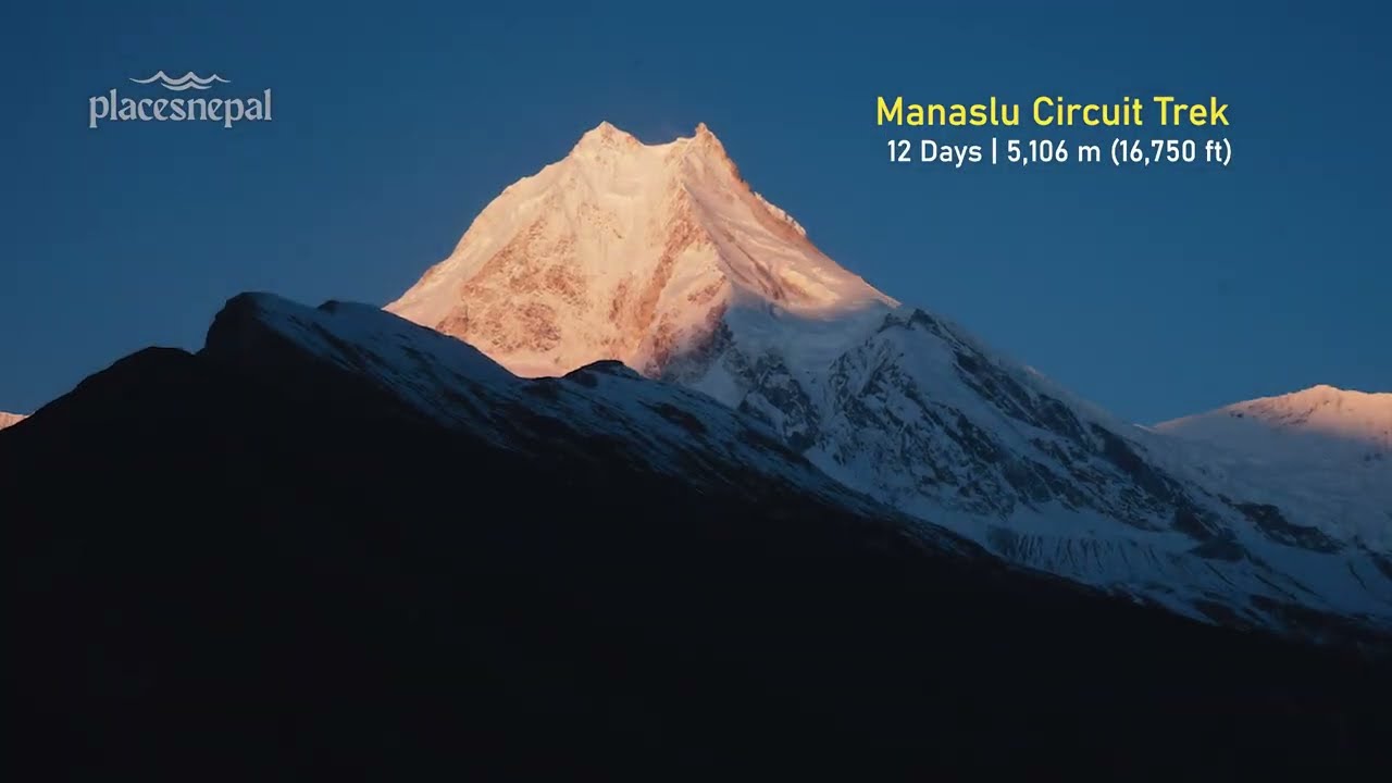
| Manaslu Circuit Trek | ~5,106 m (Larkya La) | ~4,800 m | High |
| Annapurna Circuit Trek | ~5,416 m (Thorong La) | ~4,200 m | High |
| Langtang Valley Trek | ~4,984 m (Tserko Ri) | ~3,900 m | Moderate–High |
The Three Passes Trek and the standard EBC trek share the same summit and sleeping-altitude records because they run through the same terrain at their highest points — what separates them is duration, number of high-altitude exposures, and total time spent above 4,000 m, not a different maximum elevation.
How Fast Should You Trek at Altitude?
Slower is generally better above 4,000 m, and this isn't a matter of preference — it's a practical response to reduced oxygen availability. A consistent, unhurried pace — often described locally as the "Khumbu shuffle" — outperforms pushing hard and needing repeated stops. Rest at natural intervals, hydrate consistently rather than only when thirsty becomes acute, and eat a full meal even when appetite drops, since altitude reliably suppresses hunger while the body's caloric demand actually increases.
Does Sleep Quality Affect Acclimatization?
Sleep genuinely becomes more difficult at higher elevations — periodic breathing, lighter and more fragmented sleep, and more frequent waking are common and are not automatically a sign of a serious problem. Gorak Shep in particular, at 5,140 m, is widely reported by trekkers as the poorest night's sleep of the entire route. Practical comfort measures — a sleeping bag rated to at least −15°C, warm layers worn to bed, and earplugs for shared teahouse walls — help with comfort, though they don't change the underlying altitude physiology. This is general guidance, not a medication recommendation.
Hydration and Food at Altitude
Drink consistently through the day rather than only when thirsty — 3–4 litres daily is a reasonable target above 4,000 m — and eat enough, even on days when appetite has clearly dropped. Carbohydrate-heavy meals like dal bhat, soups, and noodle dishes are generally more digestible at extreme altitude than heavy or fatty food. Avoid relying on alcohol for hydration; it does the opposite of what's needed at these elevations.
Pulse Oximeters: What They Do and Don't Tell You
A pulse oximeter can be a useful piece of information at altitude, but it should not be used alone to decide whether someone is fit to continue. A reasonable-looking blood oxygen reading doesn't rule out early AMS, and a low reading in isolation doesn't automatically mean descent is required — symptoms and overall clinical presentation matter more than a single number. There is no universal SpO₂ threshold that applies safely to every trekker at every altitude, and this article doesn't attempt to set one.
How a Guide Manages Altitude on the Three Passes Trek
An experienced high-altitude guide's value on a route like this comes down to specific, practical judgment: monitoring symptoms across the group, managing pace so the group doesn't outrun its own acclimatization, assessing route and weather conditions on pass mornings, checking hydration and food intake, and making the harder call — delaying or turning back a pass attempt — when conditions or a trekker's condition call for it. A guide's experience meaningfully reduces risk. It does not replace medical judgment, and no guide can diagnose or treat every altitude-related medical emergency in the field; serious cases require descent and, where necessary, evacuation.
When a Pass Should Not Be Attempted
Fresh snowfall, poor visibility, unsafe trail conditions, significant altitude symptoms within the group, or simply an unfavorable read on group condition are all legitimate reasons to delay or reroute a pass attempt on Kongma La, Cho La, or Renjo La. The itinerary is a plan, not an obligation that overrides safety judgment on the day. This isn't a hypothetical caveat — Cho La in particular can close temporarily after heavy snowfall, and guides are expected to make that call on the morning of the crossing rather than trekkers deciding for themselves.
Acclimatization Is Not Guaranteed
This is worth stating without qualification: a well-designed itinerary — gradual sleeping-altitude progression, properly placed acclimatization days, sensible pacing — can reduce avoidable altitude stress, but it cannot guarantee that any individual trekker will acclimatize successfully. Physiological response to altitude varies significantly between individuals and isn't reliably predicted by fitness level, age, or prior high-altitude experience. This is precisely why symptom awareness and a willingness to communicate with your guide matter regardless of how sound the underlying itinerary is.
Seasonal Effects on Altitude
The same elevation can feel meaningfully different depending on temperature, wind, snow cover, trail condition, personal exposure and clothing, and accumulated fatigue — not because the oxygen content of the air changes significantly by season, but because cold, wind, and difficult underfoot conditions all add physiological load on top of the baseline effect of altitude. A clear October morning on Cho La and a windy, snow-covered one in late November are functionally different experiences of the same 5,420 m elevation. For month-by-month conditions across the whole route, see Best Time for the Three Passes Trek.
Places Nepal's Current Acclimatization Structure, Summarized
Pulling the full picture together, on the current 17-day itinerary:
- Namche (Days 2–3) — gradual arrival at 3,440 m, followed by a scheduled acclimatization day built around the Hotel Everest View hike
- Dingboche and Chhukung (Days 5–6) — staged sleeping-altitude increases into the 4,400–4,700 m range, with a deliberately short day directly before Kongma La
- Gokyo (Days 11–12) — recovery day after Cho La, followed by the second scheduled acclimatization day built around the Gokyo Ri hike
- High-pass sequencing — Kongma La, Cho La, and Renjo La spaced three and two days apart respectively, rather than consecutive
- Recovery/descent days (14–16) — sleeping altitude decreases in three of the final four nights, well before the trek concludes
None of this is presented as a substitute for a trekker's own symptom awareness, fitness preparation, or willingness to communicate openly with a guide.
Three Passes Trek With Places Nepal
Places Nepal runs the Everest Three Passes Trek as a locally operated 17-day, Kathmandu-to-Kathmandu circuit, with the gradual altitude progression and acclimatization structure described throughout this article, along with Everest Base Camp, Kala Patthar, the Gokyo Lakes, and Gokyo Ri built into the standard route.
The 17 day trek includes round-trip Kathmandu (or Manthali) to Lukla flights, a licensed high-altitude guide for all 17 days, all required Sagarmatha National Park and Khumbu permits, and 16 nights of teahouse accommodation with full board on the trail. Rescue insurance covering high-altitude helicopter evacuation to at least 6,000 m is required for this route, given the terrain the three passes cross.
To be clear about what the itinerary does and doesn't do: it's designed to reduce avoidable altitude stress through sensible sequencing. It does not, and cannot, prevent altitude sickness in every trekker who follows it. For the complete day-by-day breakdown of the route, see the 17-day Everest Three Passes Trek itinerary, and for current pricing, departure dates, and full inclusions, see the Everest Three Passes Trek trip page.
Customizing the Acclimatization Schedule
Places Nepal also runs the Three Passes Trek as a private, customized departure for solo travelers, couples, and private groups. On a private itinerary, it's possible to add an extra buffer or acclimatization day — around Namche, Chhukung, or Gokyo, for example — or to adjust overall pace. What customization does not do is remove the underlying altitude or terrain: the passes and their elevations stay the same regardless of how the trip is booked, and an extra day doesn't automatically guarantee better acclimatization for a given individual — it simply gives the body more time, which generally helps but isn't a certainty. Discuss specific adjustments directly with the Places Nepal team, including via WhatsApp, when planning a private departure.
Group Joining
The 17-day itinerary is also available as a fixed-departure group joining trek, at published group rates for two or more people. See the Everest Three Passes Trek trip page for current departure dates.
Frequently Asked Questions
What is the highest altitude on the Three Passes Trek? Kala Patthar, at approximately 5,545 m, reached on Day 9. It is higher than Everest Base Camp and higher than any of the three passes.
What is the highest sleeping altitude on the Three Passes Trek? Gorak Shep, at 5,140 m, on Day 8 — the only overnight stop above 5,000 m on the entire route.
How do you acclimatize for the Three Passes Trek? Through gradual sleeping-altitude progression over the first six nights, two scheduled acclimatization days (Namche on Day 3, Gokyo on Day 12) built around climb-high, sleep-low hikes, short positioning days before the hardest crossings, and deliberate spacing between the three passes.
What is Chhukung Ri used for? It's an optional acclimatization day hike near Chhukung, giving higher daytime altitude exposure before returning to sleep at the village. It is not part of Places Nepal's standard 17-day itinerary but can be added on a private departure.
What is Gokyo Ri used for? Gokyo Ri (5,357 m) is the trek's second scheduled acclimatization hike, climbed on Day 12 from Gokyo village, with the group returning to sleep at Gokyo the same night.
How high is Kongma La? Approximately 5,535–5,540 m — the highest of the three passes, crossed on Day 7.
How high is Cho La? Approximately 5,420 m, crossed on Day 10, connecting Dzongla to Thagnak.
How high is Renjo La? 5,360 m, crossed on Day 13, connecting Gokyo to Marulung.
Is the Three Passes Trek safe from altitude sickness? No itinerary is. The current route is designed to reduce avoidable altitude stress through gradual progression and scheduled acclimatization, but altitude illness remains a genuine risk at these elevations, and individual response varies.
How many nights do you spend above 4,000 m? Nine, based on Places Nepal's current 17-day sleeping-altitude sequence: Dingboche, Chhukung, Lobuche, Gorak Shep, Dzongla, Thagnak, Gokyo (two nights), and Marulung.
How many nights do you spend above 5,000 m? One — Gorak Shep, on Day 8.
What is the highest point of the Everest Three Passes Trek? Kala Patthar, at approximately 5,545 m — not one of the three passes.
Is Namche an acclimatization day? Yes — Day 3, built around an optional hike to Hotel Everest View (3,880 m), with the overnight remaining at Namche's 3,440 m.
Is Kala Patthar part of acclimatization? It functions as a climb-high, sleep-low exposure ahead of Cho La, since the day continues on to a lower overnight at Dzongla — but it's primarily presented as the trek's premier viewpoint rather than a dedicated rest day.
Which pass has the highest altitude? Kongma La, at approximately 5,535–5,540 m.
Is the Three Passes Trek harder than EBC because of altitude? It involves more total time above 4,000 m and three additional high-altitude crossings the standard EBC trek doesn't include, even though both routes share the same highest point and highest sleeping altitude.
When should you descend? When altitude-related symptoms are worsening rather than settling with rest. This should be communicated to a guide immediately rather than managed privately.
Does a guide monitor altitude sickness? Yes, guides monitor symptoms, pace, and group condition throughout, and can recommend descent — but a guide is not a substitute for medical care.
Does "climb high, sleep low" apply to Three Passes? Yes — visibly on Day 3 (Namche), Day 9 (Kala Patthar to Dzongla), and Day 12 (Gokyo Ri), though it's an organizing principle rather than a guarantee.
Can I do Three Passes without acclimatization days? Not on Places Nepal's standard itinerary — the two scheduled acclimatization days are built into every fixed departure and are not presented as optional.
Is the 17-day itinerary enough for acclimatization? It's built around established acclimatization principles, but "enough" depends partly on individual physiological response, which no fixed itinerary can guarantee in advance.
The Bottom Line
The Everest Three Passes Trek's altitude profile is genuinely serious — nine nights above 4,000 m, one above 5,000 m, and three separate crossings above 5,300 m. The current 17-day Places Nepal itinerary manages that through gradual sleeping-altitude progression, two scheduled climb-high-sleep-low acclimatization days, and deliberate spacing between Kongma La, Cho La, and Renjo La. What it can't do — what no itinerary can do — is guarantee that any individual trekker acclimatizes without issue. Conditions change, individual response varies, and a guide's judgment and a trekker's own symptom awareness matter throughout, not just on paper before departure.
See the current 17-day Everest Three Passes Trek for pricing, inclusions, and departure dates, or the full day-by-day itinerary for the complete route breakdown.
This article is general trekking information, not medical advice. Travelers with relevant heart, lung, or other health conditions should seek professional medical advice before undertaking a high-altitude trek.