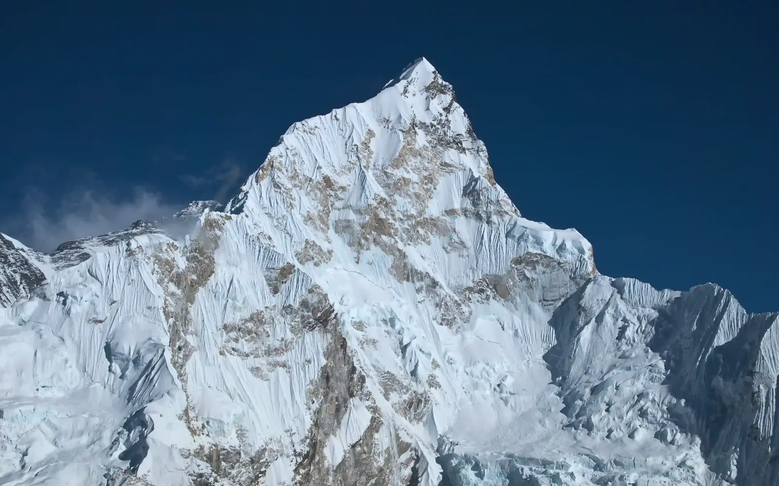
Mount Nuptse stands at 7,861 meters (25,791 feet) in Nepal's Khumbu region, forming the southwestern border of the Everest Massif within the Mahalangur Himal range.
Located 2 kilometers west-southwest of Mount Everest, this dramatic peak creates a striking visual barrier that dominates the landscape surrounding Everest Base Camp and popular trekking routes through the Khumbu Valley.
The mountain's name derives from Tibetan, translating to "West Peak"—a reference to its position relative to Lhotse. Though lower in absolute elevation than neighboring Everest (8,848.86m) and Lhotse (8,516m), Nuptse holds the distinction of being one of the most technically demanding mountains in the Everest region. Its south face rises 2,500 meters and spans 5 kilometers, creating one of the most formidable climbing challenges in the Himalayas.
Geographical Significance
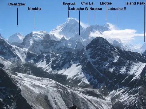
Nuptse anchors the Lhotse-Nuptse massif, connected to Lhotse by a 7,556-meter saddle that supports seven distinct peaks.
The main peak, Nuptse I, crowns an east-west trending ridge system featuring seven summits, including Nuptse II (7,827m), Nuptse Shar I (7,804m), and five other significant peaks.
This complex ridge structure contributes to Nuptse's low topographic prominence of only 319 meters, preventing it from ranking among the world's highest mountains despite its impressive elevation.
The mountain's dramatic vertical relief creates a commanding presence visible from multiple vantage points across the Khumbu region, particularly from Tengboche Monastery, Dingboche, and the Khumbu Glacier approach. Nuptse's prominent south and west faces provide stunning photographic subjects for trekkers ascending to Everest Base Camp.
First Ascent and Climbing History
Dennis Davis and Sherpa Tashi achieved the first successful ascent on May 16, 1961, via the North Ridge route—now known as the Scott Route. They were part of a British expedition led by Joe Walmsley that included accomplished climbers Chris Bonington, Les Brown, and James Swallow. Historical records indicate Tashi reached the summit first, with Davis following to document the achievement. On May 17, 1961, four additional team members summited: Bonington, Brown, Swallow, and Pemba Sherpa.
The early recognition of Nuptse's technical difficulty became evident in subsequent expeditions. A tragic 1975 joint British-Nepalese Army expedition resulted in the loss of four climbers—Major G.F. Owens, Captain R.A. Summerton, Lieutenant D.A.J. Brister, and Rifleman Pasang Tamang—who fell from the final couloir during their summit attempt.
Notable first ascents on alternate routes include the West Ridge (1984, led by Raymond Renaud) and the South Pillar of Nuptse Shar I (1994, by Michel Fauquet and Vincent Fine, who were forced to turn back 300 meters from the summit due to extreme winds). In 2008, Stéphane Benoist and Patrice Glairon-Rappaz established a route on the south face, and recent expeditions have continued opening new lines on this demanding face.
Technical Challenge and Climbing Difficulty
Nuptse's technical complexity exceeds that of many higher peaks, earning consistent comparison to elite climbs like Ama Dablam and the steep faces of Makalu. The mountain presents multiple hazards that make it significantly more difficult than its elevation suggests.
Loose snow with hidden voids, fragile cornices suspended above exposed sections, steep mixed rock-and-ice climbing, rockfall danger, and unpredictable avalanche-prone slopes characterize the typical ascent. Summit day success depends heavily on stable conditions—high winds, temperature fluctuations, and rapid weather changes frequently force climbers to retreat from near-summit positions.
The South Face, despite offering spectacular views, has seen fewer than 15 serious attempts since 1961, with a success rate below 10%. This extremely low success ratio reflects both the route's technical demands and the consistency of poor climbing conditions.
Current Climbing Statistics
Nuptse receives relatively few ascent attempts compared to neighboring peaks in the Everest region. As of 2023, approximately 65 climbers across 6 teams held permits for the mountain, with 22 recorded summits in the modern climbing era. This limited activity reflects the mountain's demanding nature and serves as a filter ensuring only experienced mountaineers with advanced technical skills attempt the peak.
Route Options
The North Ridge (Scott Route) remains the standard climbing route, following the original 1961 line. Alternative approaches include the West Ridge and various South Face variations. Each route demands proficiency in ice climbing, mixed terrain movement, and high-altitude mountaineering skills. Most expeditions establish three high camps before launching a summit bid.
Best Climbing Season
Spring (March-May) and autumn (September-December) offer the most stable climbing windows. Spring conditions typically feature 5-15°C daytime temperatures at base camp, calmer winds, and clear visibility of surrounding peaks.
Autumn provides similar advantages with less crowded trekking routes. Summer monsoon conditions create dangerous avalanche risk and poor visibility, making this season unsuitable for climbing attempts.
Cultural and Environmental Context
Nuptse maintains significant cultural importance for local Sherpa communities in the Khumbu region and serves as a sacred element within Buddhist traditions prevalent in the area.
The mountain forms a central component of the Everest experience, visible throughout the approach trek and a prominent feature in the landscape surrounding Nepal's highest national monument.
Conservation efforts focus on minimizing environmental impact in the fragile high-altitude ecosystem while managing the increasing footprint of climbing expeditions. The mountain's lower slopes support alpine vegetation and wildlife typical of the Himalayan high-altitude zone, while summit areas remain barren and inhospitable.
Nuptse: Trekking Routes and the Everest Base Camp Trek
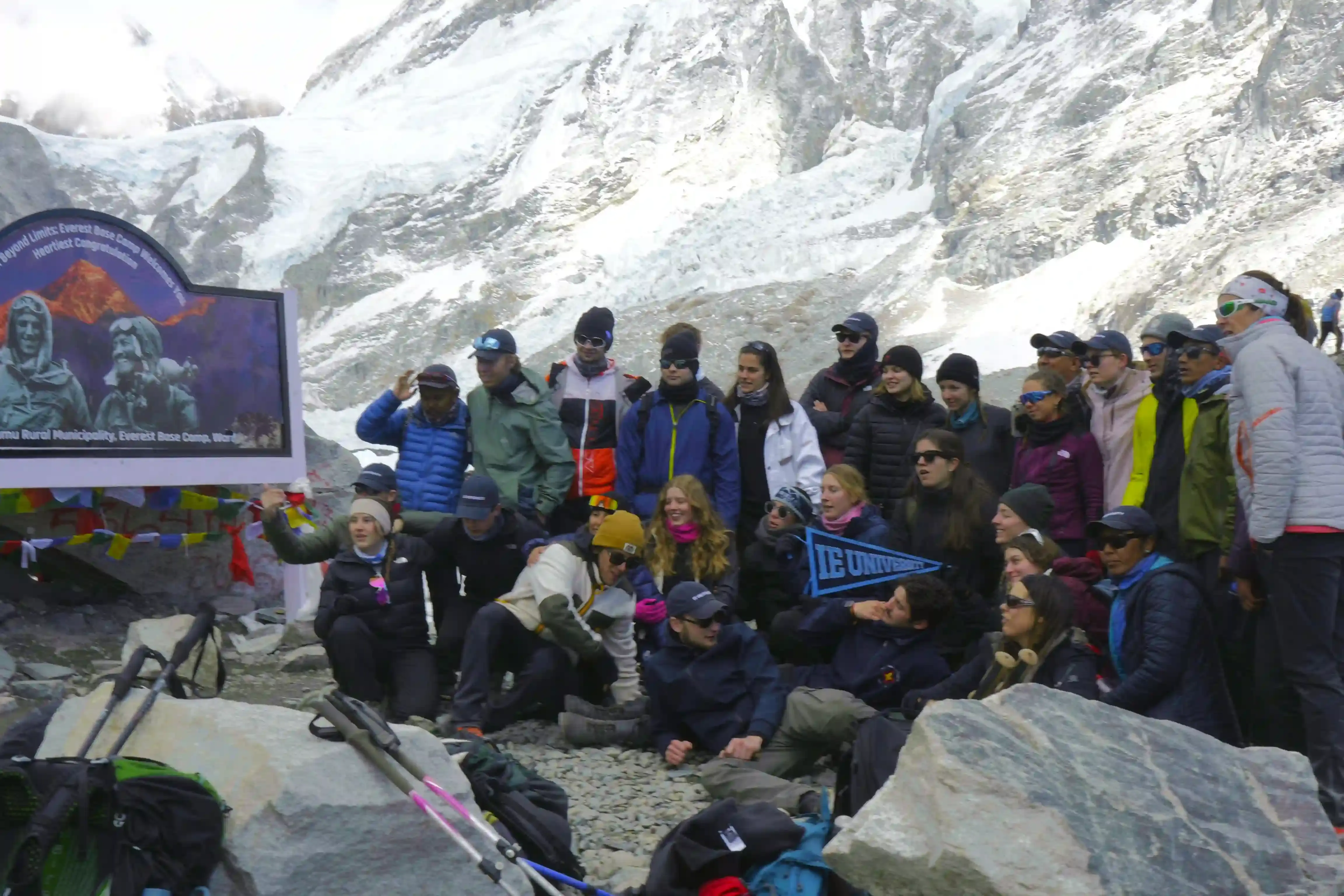
Trekking the Everest Base Camp Trail
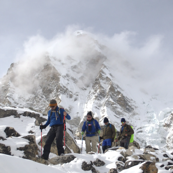
While few climbers attempt Nuptse's technical summit, the mountain dominates the landscape of one of the world's most renowned trekking routes—the Everest Base Camp Trek.
This iconic trail traverses the Khumbu Valley through Sherpa villages, Buddhist monasteries, and alpine terrain, offering unobstructed views of Nuptse from multiple perspectives.
Trekkers consistently identify Nuptse as one of the most striking peaks visible along the route, particularly when viewed from Gorakshep and Kala Patthar, where it forms a commanding ice-and-rock facade above the Khumbu Glacier.
The Everest Base Camp trek typically takes 12 to 14 days, including acclimatization days, with the standard itinerary covering a round-trip journey from Lukla to Everest Base Camp. Most trekkers reach base camp in 8 days and return in 4 to 5 days, covering approximately 130 kilometers total (65 kilometers one way).
The route begins with a flight from Kathmandu to Lukla, an airport that was rated the most dangerous airport in the world for more than 20 years by the History Channel's "Most Extreme Airports" program.
The runway is only 527 meters long with an 11.7% gradient, and operates with a single runway used for both landing and takeoff. From Lukla, trekkers proceed through rhododendron forests, suspension bridges, and scenic gorges before reaching higher elevations where Nuptse, Everest, and Lhotse dominate the horizon.
Trek the Everest Base Camp Trek
This classic trek takes you through the heart of the Khumbu region, past vibrant Sherpa villages, ancient monasteries, and towering Himalayan peaks.
Seasonal Trekking Conditions
Spring (March to May) and autumn (September to November) provide optimal trekking windows. Spring conditions feature warm daytime temperatures, blooming rhododendron flowers, and clear visibility.
Autumn offers stable weather, bright skies, and less crowded trails. Winter presents harsh conditions with extreme cold, while the monsoon season (June to August) brings heavy rainfall, poor visibility, and landslide risk, making it unsuitable for trekking.
Trekking Permits Required
To trek in the Everest region, you need two permits:
1. Sagarmatha National Park Entry Permit
Foreigners: NPR 3,000 per person
SAARC nationals: NPR 1,500 per person
Nepalese citizens: NPR 100 per person
2. Khumbu Pasang Lhamu Rural Municipality Entry Permit
Up to 4 weeks: NPR 2,000 per person
More than 4 weeks: NPR 2,500 per person
These fees help fund environmental conservation and support local community development in the Everest region.
These permits can be purchased at the trailhead in Monjo or Lukla, though obtaining them in Kathmandu beforehand is recommended to save time.
Key Trekking Villages and Landmarks
Namche Bazaar (3,440 meters) serves as the gateway to the Everest region and the primary acclimatization hub. This bustling Sherpa settlement offers shops, teahouses, restaurants, and guesthouses where trekkers rest and adjust to higher altitude. Nuptse, Lhotse, and Everest are visible together from vantage points around Namche, creating one of Nepal's most iconic panoramic views.
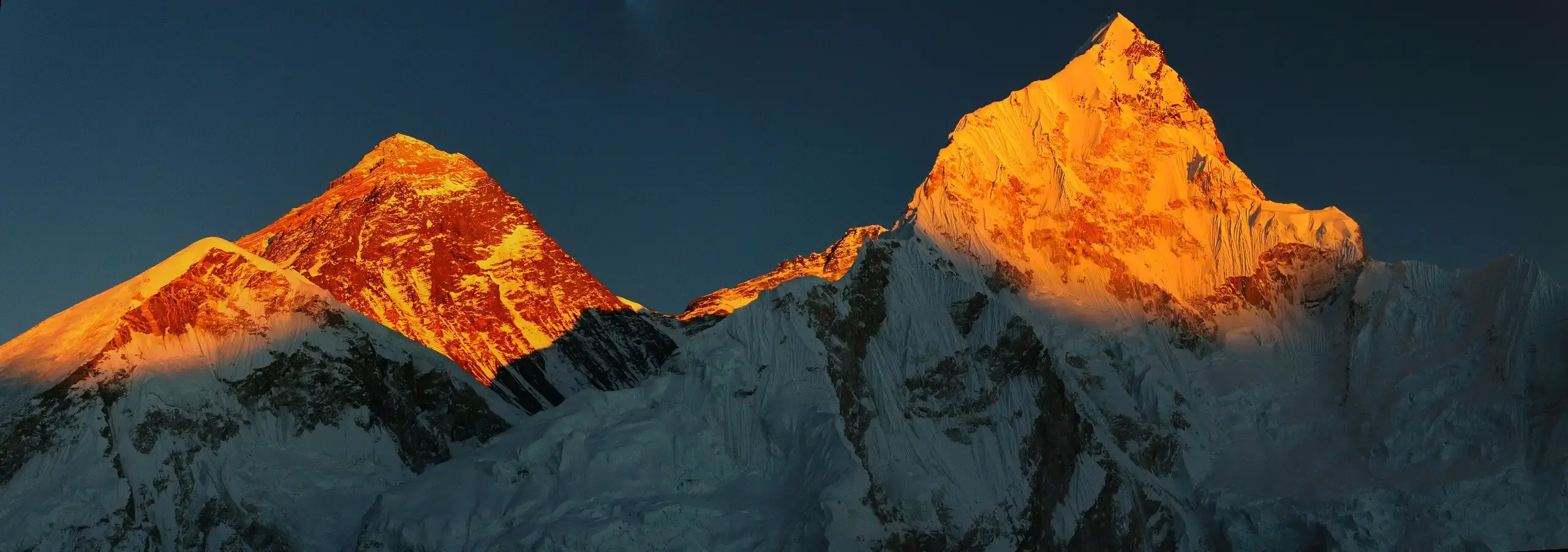
Tengboche hosts the Tengboche Monastery (3,867 meters), a significant Buddhist cultural center surrounded by coniferous forests. The monastery offers breathtaking views of Nuptse glowing golden at sunrise. The sacred site attracts pilgrims and trekkers seeking cultural immersion, and the surrounding monastic community maintains Buddhist traditions dating centuries.
Dingboche (4,360 meters) features stone-walled agricultural fields and yak herds typical of high-altitude Sherpa settlements. The village provides unobstructed eastern ridge views of Nuptse and the looming south faces of Lhotse and Ama Dablam. Day hikes from Dingboche offer panoramic perspectives of surrounding peaks and serve as critical acclimatization training.
Lobuche and Gorakshep mark the final approach to Everest Base Camp. From Gorakshep (5,190 meters), Nuptse's 2,500-meter south face dominates the landscape, appearing massive and immediate as it towers above surrounding glacial terrain.
Kala Patthar (5,555 meters), accessible via a 2- to 2.5-hour ascent from Gorakshep, provides the trek's highest vantage point and the most celebrated sunrise viewing location. From this rocky outcrop, Nuptse sits prominently in the center of the emerging sunrise, its jagged ridges and corniced edges illuminated against the dawn sky.
Teahouse Lodging and Local Hospitality
Teahouses and stone-built lodges accommodate trekkers throughout the route, providing basic but comfortable accommodations. These family-run establishments offer warm meals, hot beverages, and communal dining spaces where trekkers interact across cultures.
Sherpa cuisine features momos (dumplings), dal bhat (rice and lentils), yak stew, noodle soups, and butter tea—traditional foods that provide essential calories for high-altitude exertion.
Lodge interiors commonly display photographs from historic expeditions, documenting mountaineering achievements and trekking history. These visual reminders connect contemporary trekkers to the region's climbing heritage and Sherpa accomplishments.
Alternative Trekking Routes Featuring Nuptse
The Island Peak Base Camp route offers views of Nuptse along approach trails. The Chukhung Valley extension provides close-range perspectives of Nuptse's technical ridges. The Amphu Labtsa Pass trek follows a less-traveled path with distinct Nuptse views. Each route showcases different aspects of the mountain's architecture and surrounding geography.
For mountaineers, Nuptse access typically routes through Everest Base Camp. Only advanced teams with technical rock and ice climbing expertise can attempt the mountain's challenging ridges.
The terrain demands specialized equipment, high-altitude acclimatization, and exceptional mountaineering judgment. Routes exceeding 45–55 degrees of steepness, mixed rock-and-ice sections, and unstable seracs characterize the climbing experience.
Environmental and Cultural Significance
Nuptse maintains profound cultural importance within local Sherpa Buddhist traditions, serving as a sacred landscape element. The mountain forms a central component of pilgrimage routes and spiritual practices throughout the Khumbu region.
Conservation efforts in the Sagarmatha National Park focus on minimizing trekking impact while preserving the fragile alpine ecosystem. Trekkers are required to carry out all waste, use designated cooking areas, stay on established trails, and respect local cultural sites.
These regulations protect vegetation, prevent soil erosion, preserve wildlife habitats, and maintain the region's pristine conditions for future generations.
Nuptse: Geology, Geography, and Cultural Significance
Mountain Architecture and Geological Features
Nuptse is composed primarily of granite and metamorphic rock formations, specifically gneiss and schist, which resulted from the tectonic collision between the Indian and Eurasian plates that formed the Himalayan range.
The mountain features a massive ridge system with seven distinct summits, with the western face dropping more than 2,300 meters to the Khumbu Glacier and a south face standing 2,500 meters high and 5 kilometers wide at its base.
The seven summits along the Nuptse ridge, from west to east, are: Nuptse Nup II (7,742m), Nuptse Nup I (7,784m), Nuptse I—the main summit (7,861m), Nuptse II (7,827m), Nuptse Shar I (7,804m), Nuptse Shar II (7,776m), and Nuptse Shar III (7,695m). Each peak presents distinct climbing challenges, with the main summit connected to Lhotse by a 7,556-meter saddle.
Nuptse's dramatic vertical relief creates significant avalanche terrain and icefall zones. The mountain's north face overlooks the famous Khumbu Icefall, which serves as the approach corridor for Everest expeditions. The unpredictable nature of seracs, hidden crevasses, and rapidly shifting ice make approach routes hazardous even for acclimatized climbers.
Geographical Position and Visual Prominence
Located at coordinates 27.96°N, 86.89°E in the Mahalangur Himal subrange, Nuptse stands 2 kilometers west-southwest of Mount Everest. Despite its significant elevation, Nuptse ranks as only one of Earth's lower 7,000-meter peaks due to its topographic prominence of just 319 meters—a measurement indicating its relative independence from neighboring peaks.
Paradoxically, Nuptse's lower prominence combined with its dramatic vertical relief creates an optical illusion. When viewed from Everest Base Camp and Kala Patthar, Nuptse often appears taller than Everest itself, dominating the visual landscape.
From Gorakshep, its 2,500-meter south face creates an overwhelming presence that completely fills the skyline. This visual dominance has made Nuptse a central feature in countless photographs and artistic depictions of the Everest region.
Glacier systems surrounding Nuptse—particularly the Khumbu, Kangmi, and Imja glaciers—feed river systems that drain southward through the Khumbu Valley, ultimately contributing to river networks that reach lowland Nepal.
These glaciers represent critical hydrological features supplying meltwater to downstream communities and ecosystems.
Cultural and Spiritual Significance
For local Sherpa communities, mountains are not geological features but sacred entities embodying divine protection and spiritual authority. Nuptse, Everest, and Lhotse form what many refer to as a sacred trinity in Tibetan Buddhist tradition, with each peak representing different aspects of Buddhist cosmology and protective deities.
Prayer flags positioned across suspension bridges and mountain passes release blessings into surrounding valleys beneath Nuptse. These colorful fabric strips serve simultaneously as spiritual objects and practical indicators of safe passage in the mountain landscape.
The Mani Rimdu Festival, celebrated annually at Tengboche Monastery, involves traditional masked dances called Cham and sacred tantric rituals performed by lamas. The festival spans 19 days and celebrates the founding of Buddhism by Guru Rinpoche Padmasambhava, with public ceremonies typically occurring in October or November according to the Tibetan lunar calendar.
During this festival, monks perform ritualistic dances symbolizing the triumph of Buddhist forces over malevolent Bon traditions, with each movement and gesture conveying Buddhist philosophical teachings.
Sacred Mani Rilwu (spiritual medicine pills) and Tshereel (longevity pills) are distributed to festival attendees during Wong ceremonies, where high lamas bestow blessings and spiritual empowerment.
Mountaineers attempting Everest and neighboring peaks participate in pre-expedition puja ceremonies at base camp, seeking blessings from Buddhist lamas and requesting protection from mountain protective spirits. These rituals represent a practical acknowledgment that climbing success depends partly on respecting the sacred nature of mountains within Sherpa cosmology.
Local Spiritual Practices
Sherpa households conduct blessing ceremonies before members undertake expeditions or treks, seeking the mountains' protective spirits' favor. Incense offerings, prayer wheels, and sacred mantras accompany these rituals, reflecting the integrated relationship between daily Sherpa life and mountain spirituality.
Pangboche Monastery and Tengboche Monastery serve as primary spiritual centers for the Khumbu region, with Tengboche Monastery located at an altitude of 3,867 meters, established over three centuries ago as an important spiritual site recognized as the spiritual hub of the Everest region. These monasteries maintain continuous Buddhist traditions while remaining pilgrimage destinations for Sherpa communities seeking blessings before alpine ventures.
The mountains' protective functions extend to community welfare, with local beliefs suggesting that maintaining respectful relationships with peaks ensures stable weather patterns, successful harvests, and general prosperity. This indigenous environmental philosophy establishes mountains as active participants in human flourishing rather than merely passive landscapes.
Spiritual Landscape and Modern Connections
For contemporary mountaineers, Sherpa spiritual practices represent important cultural touchstones rather than superstitions. Many climbers report that participating in puja ceremonies and mountain blessings deepens their psychological preparation and establishes meaningful relationships with local Sherpa teams. This spiritual engagement transforms Nuptse from a technical climbing objective into a sacred geography worthy of reverence.
The integration of Nuptse into Sherpa spirituality demonstrates how mountains function as multidimensional entities simultaneously serving geological, economic, cultural, and spiritual roles. Understanding these dimensions provides essential context for comprehending the Khumbu region's character and the complex relationship between human communities and the Himalayan landscape.
Nuptse: Photography Locations and Climbing Statistics
Premier Photography Viewpoints
Nuptse's dramatic architecture and position relative to surrounding peaks create exceptional photography opportunities throughout the Everest region. The mountain's south face—spanning 5 kilometers in width with 2,500 meters of vertical relief—dominates multiple trekking vantage points.
Kala Patthar (5,545 meters)
Kala Patthar provides unparalleled photography opportunities, allowing trekkers to capture panoramic views of Mount Everest, Nuptse, Pumori, and surrounding Himalayan giants alongside the Khumbu Glacier. From this elevated position, photographers can see Everest's summit pyramid, the Hillary Step, and South Col in one frame—a perspective unavailable from Everest Base Camp, where Nuptse's massive wall completely blocks Everest's peak.
Sunrise at Kala Patthar produces golden alpenglow illuminating Everest and surrounding peaks, creating unforgettable spectacles. Sunset climbs offer slightly lower visibility but warmer temperatures and smaller crowds, with softer afternoon light creating ideal conditions for silhouette photography against Pumori's ridges.
Dingboche Ridge
The alpine village of Dingboche (4,360 meters) offers close-range perspectives of Nuptse's eastern ridge system. Early morning light casts pastels across the mountain's eastern faces, providing distinct photographic contrasts compared to sunrise views from higher elevations.
Tengboche Monastery (3,867 meters)
Prayer flags and ancient coniferous forests frame Nuptse from Tengboche Monastery, particularly during sunrise when the peak glows golden against emerging light. This sacred vantage point captures Nuptse within its cultural and spiritual landscape context.
Namche Bazaar (3,440 meters)
Though lower in elevation, Namche Bazaar offers panoramic perspectives revealing Nuptse, Lhotse, and Everest together. The village's multi-angle viewing opportunities allow photographers to capture the mountains' relationships within the surrounding geography.
Lighting and Seasonal Photography Considerations
Afternoon and evening light produces striking color shifts across Nuptse's ice and rock. The transition from bright white to oranges, golds, and pinks during late afternoon provides memorable photography moments. Autumn (September-November) and spring (March-May) offer optimal visibility, stable weather patterns, and clear skies for capturing mountain detail.
Climbing Statistics and Difficulty Context
Nuptse's low visitation rate reflects its demanding technical character rather than accessibility issues or remoteness.
Summit Attempt Data
According to the Himalayan Database, the south face has been attempted only 14 times since 1961, and the mountain itself has seen just 60 expeditions—less than 10 percent of which achieved success. Only approximately 20 climbers have ever summited Nuptse across roughly six expeditions since the first ascent in 1961. By comparison, as of the end of 2024, over 12,884 people had summited Everest, including 9,156 from the Nepalese side.
Modern permit data indicates at least 65 climbers in 6 teams have obtained permits for Nuptse, suggesting recent expedition activity, though historical success rates remain extremely low.
Triple Crown Achievement
Summiting Everest, Lhotse, and Nuptse in a single season—the "Triple Crown"—has been accomplished by only four people as of 2025. Nuptse remains the most technical element of this combination, with experienced guides describing it as requiring "technical rock and ice skills, steep and exposed terrain demanding precision on mixed terrain," with weather remaining unpredictable and the summit ridge sharp and dangerous.
Why Nuptse Remains Underestimated
Several factors limit Nuptse climbing attempts despite its proximity to Everest:
Nuptse's elevation of 7,861 meters—139 meters below the 8,000-meter threshold—discourages peak collectors who prioritize 8,000-meter summits. The mountain's long, sustained steepness discourages most climbers from using it as an acclimatization peak for Everest or Lhotse, and hard-core alpinists typically pursue alpine-style ascents of particular lines rather than reaching the main summit.
Technical difficulty on Nuptse exceeds that of Everest or Lhotse, with multiple very technical sections on the North Ridge beyond what typically appears on neighboring peaks.
Route Conditions and Hazards
Nuptse's climbing challenges include loose snow with hidden voids, fragile cornices, sustained mixed rock-and-ice terrain, rockfall danger, and avalanche-prone slopes. Unpredictable weather, high winds, and unstable snow conditions force frequent retreat decisions, particularly from near-summit positions. These conditions combine to produce one of the lowest success rates among major Himalayan peaks.
Cultural Impact Beyond Mountaineering
Nuptse's cultural influence extends beyond mountaineering—in 1992, The North Face created the Nuptse Jacket, featuring novel baffle construction to reduce down shifting, which became iconic in urban markets throughout the 1990s and expanded to over 60 items in the product line by 2023.
Despite its challenging character, Nuptse continues attracting mountaineers seeking authentic alpine challenges in an era when guided commercial expeditions dominate higher peaks. The mountain's combination of technical difficulty, low summit count, and dramatic aesthetic position within the Everest Massif ensures its enduring significance within mountaineering culture.

