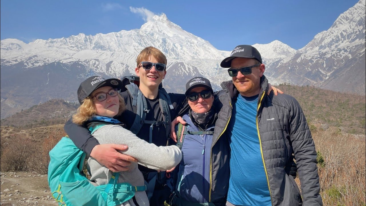
Nepal hides some of the world's most mysterious summits — unclimbed mountains in Nepal that are either divinely off-limits or simply unconquered. From the forbidden mountain of Machhapuchhre to remote eastern Himalayan giants, explore what keeps these peaks forever beyond human reach.
Quick answer: Yes. Nepal still has unclimbed mountains, but the number is smaller and harder to pin down than most lists claim. Some are permanently closed on religious grounds (Machhapuchhre), some are technically open but never successfully climbed (Anidesh Chuli), and some are simply under-documented — attempted, disputed, or newly opened rather than truly virgin.
That single sentence hides most of the confusion on this topic, and almost every article ranking for "unclimbed mountains in Nepal" gets some part of it wrong. One widely cited list still describes Amphu I as Nepal's tallest unclimbed peak — a Korean team climbed it in October 2013. Kangchenjunga gets called "unclimbed" because tradition keeps climbers a few feet short of the true summit, which is a different thing entirely from nobody having reached the top. This guide keeps those categories separate on purpose, because the distinction is the whole point.
What "Unclimbed Mountain" Actually Means
"Unclimbed" gets used loosely online to cover at least eight different situations. They are not interchangeable, and using them as if they were is the single biggest source of bad information on this topic.
| Term | What it actually means |
|---|
| Unclimbed peak | No documented successful ascent to the true summit by any route, ever. |
| Unclimbed route or face | The mountain has been climbed, but not by this specific line — common on 8,000ers, where a summit may have ten routes and only two or three climbed. |
| First ascent | The first confirmed successful climb to a summit, by any route. |
| First winter / first solo ascent | The first successful climb in a specific style or season — the peak itself is already climbed. |
| Attempted, not summited | One or more expeditions have tried and failed, retreated, or been forced back — a materially different claim from "nobody has ever tried." |
| Disputed or unverified ascent | A summit claim exists but cannot be fully confirmed — through missing documentation, navigational confusion, or conflicting accounts. The Himalayan Database tags several Nepali peaks this way rather than filing them as flatly climbed or unclimbed. |
| Newly opened peak | The government has authorized climbing permits for the mountain. This says nothing about whether anyone has actually reached the top — opening and climbing are two separate events, often years apart. |
| Virgin peak | Informal term for a genuinely unclimbed summit — used correctly only when no ascent has been documented at all. |
Keeping these apart matters because a peak can move between categories without anyone getting to the top. Anidesh Chuli went from "unclimbed, no attempts" (accurate before 2013) to "unclimbed, attempted and repelled" (accurate since) without a single successful summit changing hands. Sato Peak, near Kangchenjunga, currently sits in the Himalayan Database as "unclimbed?" — with the question mark intentional, because researchers suspect a 1960s Japanese team may have summited a neighbouring peak by mistake and claimed the wrong one. None of that is the same as "no human has ever reached this point," which is the claim older listicles tend to default to for anything remote.
Are There Still Unclimbed Mountains in Nepal?
Yes — but be wary of any source that gives you a precise count with confidence. Nepal has more than 1,300 named summits above roughly 5,650 to 6,000 metres, and government figures put the number of officially classified climbing peaks at 468, of which roughly 401 are open to expeditions, 65 are proposed for opening, and a small remainder are closed.
Not every one of those peaks has been climbed, but "unclimbed" and "undocumented" are not the same thing. Many lower, less prominent summits in far-western Nepal (Humla, Karnali, Sudurpaschim) have simply never attracted an expedition — no permit has ever been requested, so there is no record either way. That is different from a peak like Anidesh Chuli, which has an actual attempt on file that failed. Claiming "hundreds of mountains have never been climbed" — a line that circulates on several trekking sites, including the previous version of this page — overstates what anyone can actually verify. A more honest formulation: a meaningful number of Nepali peaks have no confirmed ascent, for reasons that range from genuine technical difficulty to simple lack of expedition interest, and a smaller, specific set of named peaks (Machhapuchhre, Anidesh Chuli, and others detailed below) can be described as unclimbed with real confidence because their attempt histories are actually documented.
Nepal's Mountain Landscape
Nepal holds roughly 15% of the entire Himalayan range within its borders, spread across several distinct mountain regions, each with its own permitting authority and its own concentration of lesser-known peaks:
- Khumbu (Everest region) — Solukhumbu district; includes Everest, Lhotse, Ama Dablam, and sacred Khumbila
- Kangchenjunga / Janak Himal — Taplejung district, far eastern Nepal; the highest concentration of genuinely under-attempted 6,000–7,000m peaks in the country, including Anidesh Chuli, the Sharphu group, and Sato Peak
- Makalu-Barun — Sankhuwasabha district; remote peaks around the Barun valley and the Amphu/Chamlang massif
- Manaslu / Ganesh Himal — Gorkha district; site of Lumbo Himal, Nepal's most recent confirmed first ascent
- Annapurna — Kaski and Manang districts; home to Machhapuchhre
- Dhaulagiri — Myagdi and Baglung districts
- Dolpo and Humla — Karnali Province; historically the least-documented Himalayan region in Nepal, and the location of most of the 97 peaks opened royalty-free in 2025
- Mustang and Damodar Himal — Mustang district, on the Tibetan Plateau's southern edge
Are Any of Nepal's 8,000-Metre Mountains Unclimbed?
No. Nepal's eight classic 8,000-metre peaks — Everest, Kangchenjunga, Lhotse, Makalu, Cho Oyu, Dhaulagiri, Manaslu, and Annapurna I — were all first climbed between 1950 (Annapurna I) and 1964, and all have had repeat ascents most years since. None of them are unclimbed by any reasonable definition.
There is a genuine 2026 wrinkle worth knowing, though: in February 2025, Nepal's Department of Tourism added six subsidiary summits — Yalung Kang (8,505m), Yalung Kang West (8,077m), Kangchenjunga Central (8,473m), Kangchenjunga South (8,476m), Lhotse Middle (8,410m), and Lhotse Shar (8,400m) — to its official peak profile, pushing Nepal's own count of "8,000m+ peaks" to 14. This is a permitting and classification change, not a mountaineering one: every one of those six summits already has a documented first ascent, some dating back more than fifty years (Yalung Kang, 1973; Lhotse Shar, 1970; Kangchenjunga Central and South, 1978; Lhotse Middle, 2001, by a Russian team). The UIAA, mountaineering's international governing body, has not ratified Nepal's reclassification, and the "14 eight-thousanders" figure is not used outside Nepal's own tourism promotion. The practical effect for climbers is that a permit for the main summit of Kangchenjunga or Lhotse no longer automatically covers these subsidiary points — each now requires its own separate permit and fee.
So: the 8,000m tier matters to this story mainly as context. It tells you where Nepal's mountaineering history started, not where the country's genuinely open questions remain — those sit almost entirely in the 5,800–7,200m range.
Nepal's Forbidden and Sacred Mountains
Two entirely different mechanisms keep a mountain unclimbed in Nepal, and confusing them is where most articles on this topic go wrong.
The first is legal prohibition — the government has never issued, and does not accept applications for, a climbing permit. Machhapuchhre is the clearest example: this is a specific, documented policy, not a vague cultural understanding.
The second is cultural or religious deterrence — no law explicitly bans an ascent, but the mountain is regarded as the seat of a deity, and both government practice and local pressure keep permits from being issued or attempts from being made. Khumbila falls closer to this category. The distinction matters because "sacred and forbidden" is sometimes used as a single label when the underlying mechanism — and the legal risk to anyone who tries anyway — is genuinely different.
Machhapuchhre: Nepal's Most Famous Unclimbed Peak
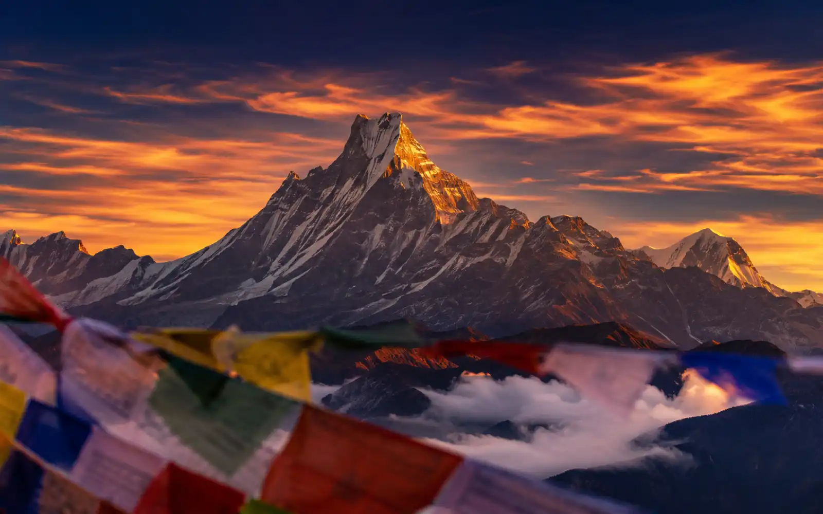
6,993 metres | Kaski District, Gandaki Province | Southeastern anchor of the Annapurna massif | Closed to climbing since the early 1960s 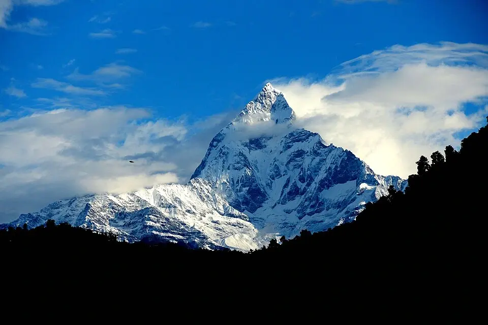
Machhapuchhre — "Fishtail," for its twin-summited profile above Pokhara — has exactly one documented high-altitude attempt in its climbing history. In spring 1957, Lieutenant Colonel James Owen Merion "Jimmy" Roberts led a British expedition that included Wilfrid Noyce (a member of the 1953 Everest team) and A.D.M. "David" Cox, along with Charles Wylie, Roger Chorley, and Sherpas including Ang Nyima, Tashi, Ang Tsering, and Da Temba. The team established base camp at roughly 3,960m in late April and pushed the north ridge route through May.
In late May 1957, Noyce and Cox reached a point roughly 150 feet (45–50m) below the true summit — an altitude close to 6,947m — before turning back. The popular account holds that they had promised, as a condition of their permit from the government, not to set foot on the actual top out of respect for local belief. At least one detailed secondary account, drawing on the expedition's own record, gives a more complicated picture: it describes the retreat as driven primarily by deteriorating weather, hard ice, route uncertainty, and time pressure, with the cultural undertaking a secondary factor rather than the sole reason. Both elements — the near-summit and the respect for local belief — are well documented; which one was decisive on the day is not something later sources agree on cleanly, and this piece is not going to manufacture certainty where the record doesn't provide it.
What is not disputed: no permit has been issued since. The Nepalese government formalized Machhapuchhre's closure as a matter of policy around 1962, and it has held for more than sixty years. In 2022, there were reportedly internal discussions in Nepal about reconsidering the ban; cultural historians and Gurung community representatives argued against lifting it, and as of 2026 the closure remains fully in place.
There is one asterisk worth knowing about, purely for completeness: the Himalayan Database carries a footnote — explicitly labelled a rumour, never confirmed — that New Zealand climber Bill Denz may have made an illegal solo ascent via the north ridge–northeast face sometime around 1980. Denz died in an avalanche on Makalu shortly afterward, and the claim was never substantiated in either direction. The mountain's official status is unaffected: Machhapuchhre remains classified as unclimbed.
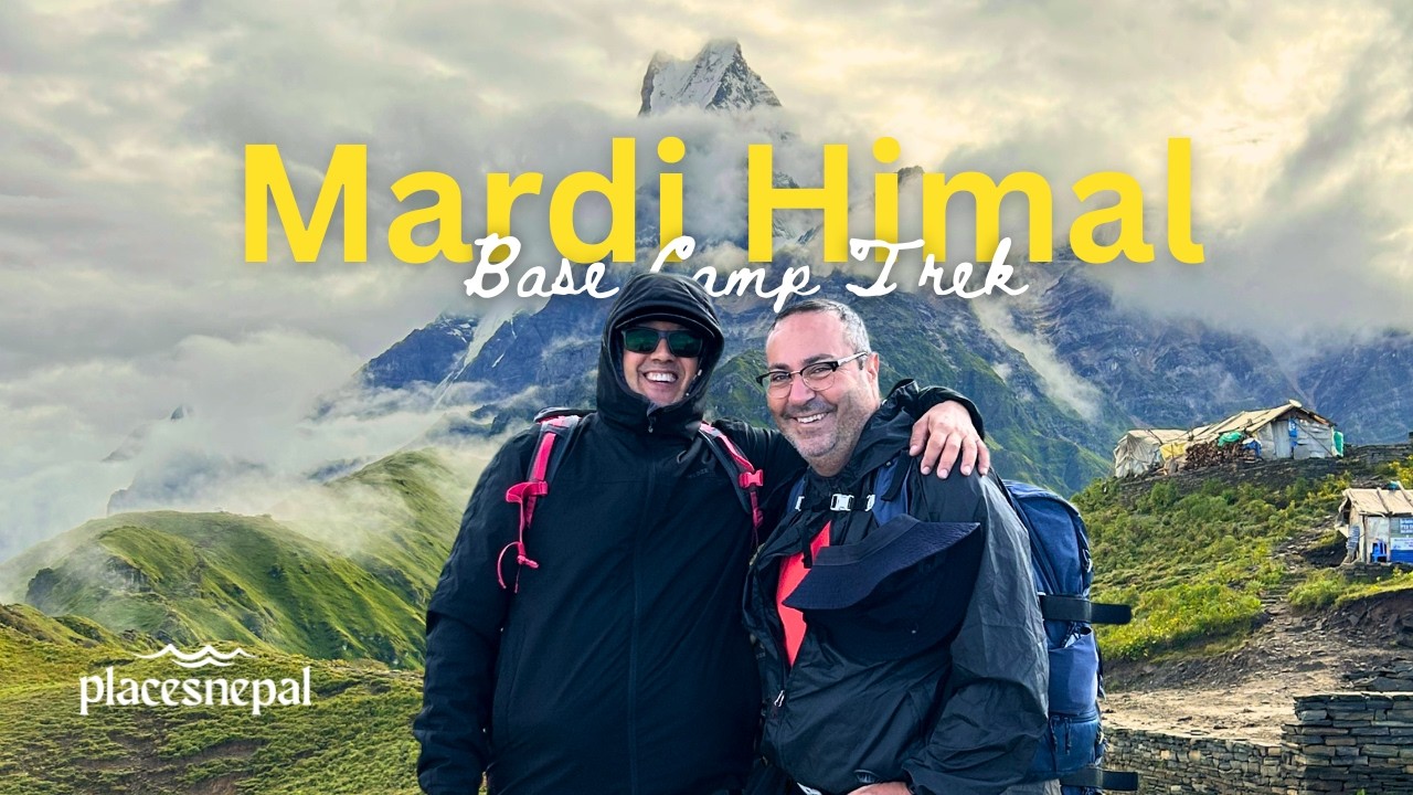
Machhapuchhre is legally closed to climbing, but you don’t need a permit to see it — it dominates the skyline throughout the Mardi Himal Trek and Annapurna Base Camp Trek. It stands directly ahead of you at the top of the Modi Khola valley. For the fuller history of the mountain, including its cultural significance to the Gurung community, see our dedicated piece on Machhapuchhre.
Khumbila: Sacred, Not Legally Forbidden
5,761 metres | Solukhumbu District, Sagarmatha National Park | Above Khumjung and Khunde villages | Never climbed 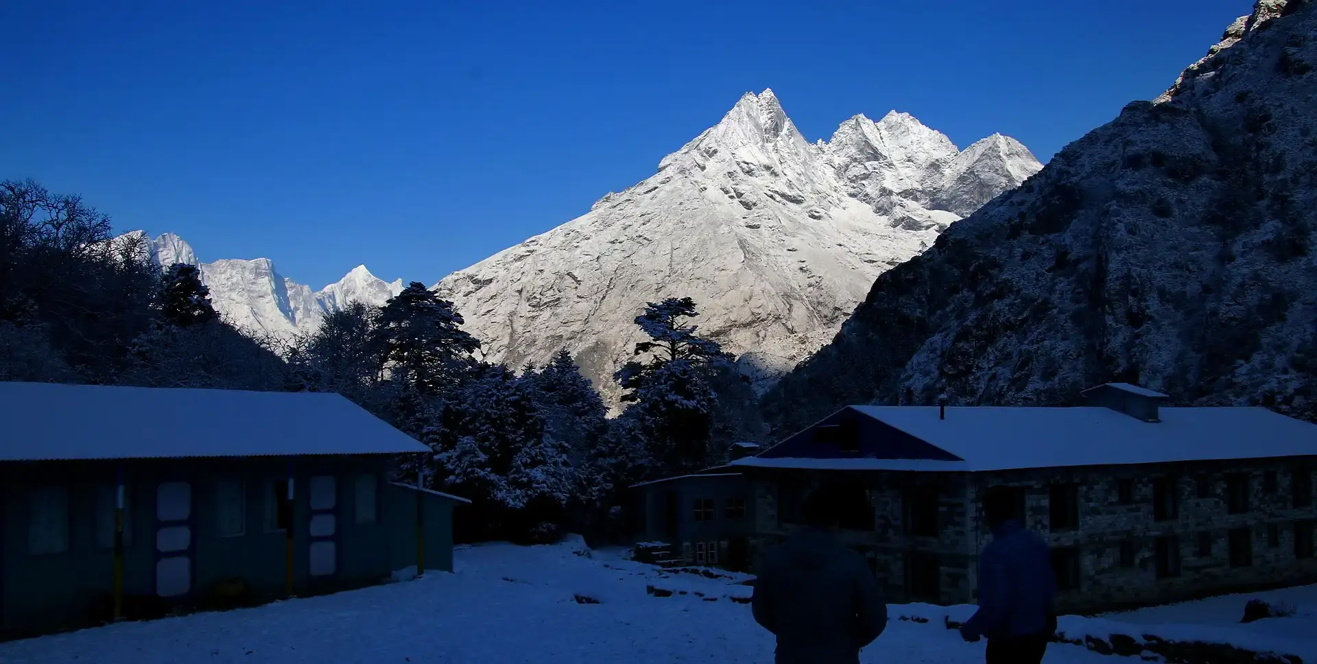
Khumbila, or Khumbu Yul Lha ("God of Khumbu"), overlooks the Sherpa villages of Khumjung and Khunde on the classic route toward Everest Base Camp. It is considered the seat of the Khumbu region's patron protective deity and is central to the Sherpa community's Dumji festival, held annually in Pangboche.
Khumbila has never been successfully climbed. One recorded attempt, before the 1980s, ended when climbers were killed in an avalanche, and there have been no confirmed attempts since. Its protection functions differently from Machhapuchhre's: rather than a single, dated act of government prohibition, Khumbila's status rests on sustained Sherpa community authority and a long-standing practice — by the Nepal Mountaineering Association, the Department of Tourism, and expedition operators alike — of not issuing or seeking permits for it. The practical outcome for a climber is the same either way: no legal route to a permit exists. But describing Khumbila's closure with the same "criminal offence" language as Machhapuchhre's overstates how the restriction is actually codified, and this piece treats the two as related but distinct cases rather than a single interchangeable "forbidden peaks" bucket.
Trekkers on the Everest Base Camp Trek pass directly through Khumbila’s territory around Khumjung and Khunde without necessarily realizing it — most visitors are focused on the Everest and Ama Dablam views further up the valley.
Kangchenjunga's Summit Tradition Is a Different Category
8,586 metres | Nepal–Sikkim (India) border | Third-highest mountain on Earth | First climbed 1955 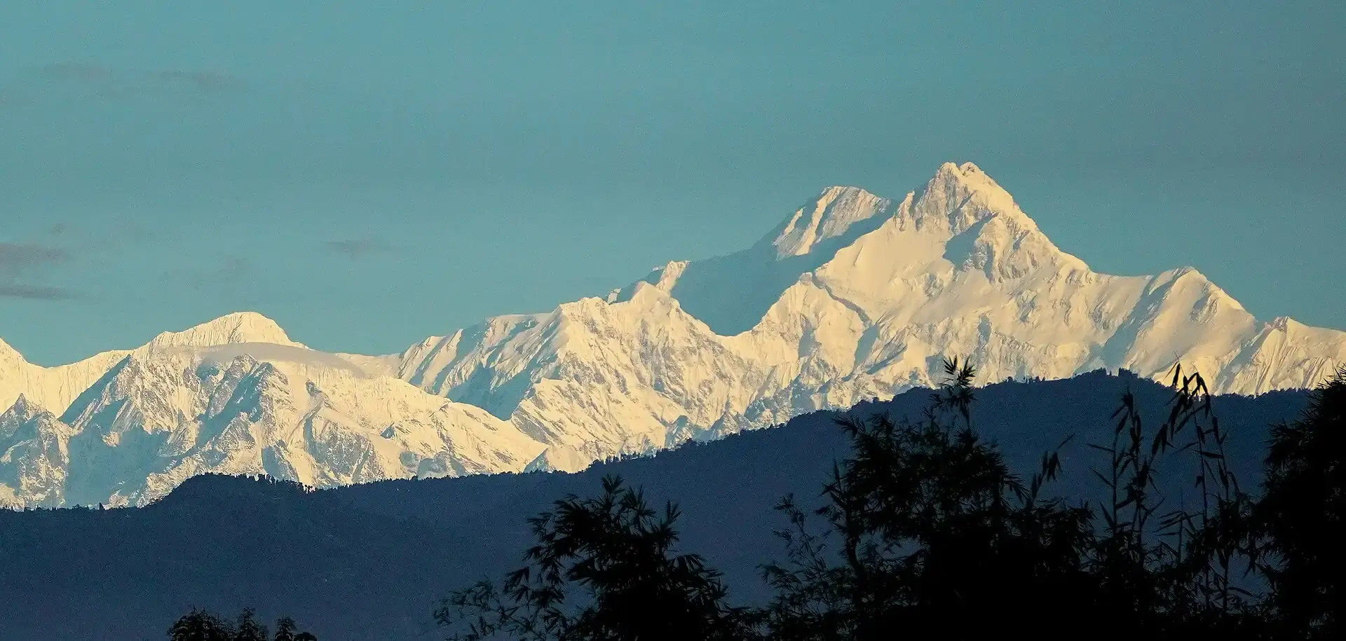
Kangchenjunga is not unclimbed, and describing it that way — as the previous version of this article did — undersells what actually happened and misrepresents the category. The 1955 British expedition, led to the Yalung Face by Charles Evans, put George Band and Joe Brown on the mountain first on 25 May 1955, followed by Norman Hardie and Tony Streather the next day. At the request of the Chogyal (king) of Sikkim, the team deliberately stopped roughly five feet below the true summit, a tradition most subsequent expeditions have chosen to honour.
That makes Kangchenjunga summited-but-untrodden by convention, not unclimbed — a subtly different category from anything else on this page, and one worth naming precisely rather than folding into a generic “forbidden” bucket. Anyone can, and people occasionally have, walked the final five feet; the vast majority don’t, out of respect for the same tradition that shaped the first ascent. Trekkers can approach the mountain’s south side on the Kanchenjunga South Base Camp Trek or circle it on the longer Kanchenjunga Circuit Trek.
Open but Unclimbed Mountains in Nepal
A peak with an active permit system and no successful ascent is the genuinely interesting category for climbers — and the one where sourcing matters most, because "nobody has climbed it" and "nobody has seriously tried" get conflated constantly.
Anidesh Chuli (also known historically as White Wave), in the Kangchenjunga Himal near Taplejung, is the best-documented case of a peak that is legally open and remains unclimbed with a real attempt on record. Officially placed on the permitted list in 2002, it saw no recorded attempts until 2013, when a four-person New Zealand team (Ben Dare, Andrei Dusschoten, Rob Frost, Scott Scheele) climbed via the northeast face to the east ridge. The attempt ended in a serious accident — team member Scott Scheele took an 80–90m fall near 6,350m and sustained head injuries — and the party was evacuated by helicopter. The American Alpine Journal, working from Himalayan Database records, gives the peak's surveyed elevation as 6,808m, notably lower than the 6,960m figure that circulates on trekking sites; both figures appear in credible sources, and this discrepancy has not been resolved in publicly available surveys. No successful ascent has been recorded since.
Chago (6,893m) and Chabuk (6,960m), both also in the Kangchenjunga Himal, are commonly listed alongside Anidesh Chuli as unclimbed.
Sato Peak (also spelled Sat Peak), near Kangchenjunga in the Janak Himal, is the sharpest current illustration of how murky "unclimbed" can get even with active expeditions on the mountain. Its elevation is disputed between roughly 6,164m and 6,220m depending on the source. A Korean Alpine Federation team attempted it in alpine style in April–May 2026; earlier attempts came from an Italian pair in 2022 (who reached a foresummit called the Sato Pyramide, at 6,100m) and a Japanese team in 2023. The Himalayan Database currently tags the peak "unclimbed?" — the question mark is deliberate, reflecting a suspicion that a Japanese team in the 1960s may have summited a neighbouring peak, Nupchu, while believing it was Sato. That is a genuinely unresolved case, not a confidently unclimbed one, and it's a useful reminder of how identification errors compound in remote, poorly mapped terrain.
Newly Opened Mountains in Nepal
"Newly opened" is a permitting event, not a climbing one, and treating the two as synonymous is one of the more common errors in this topic area.
In July 2025, Nepal opened 97 remote peaks across Karnali and Sudurpaschim provinces — 77 in Karnali, 20 in Sudurpaschim — for royalty-free climbing through the 2025–2026 and 2026–2027 seasons, an initiative aimed at drawing expedition traffic away from the crowded Khumbu and Annapurna regions and into Nepal's least-visited far west. The peaks range from roughly 5,870m to 7,132m.
Opening a peak requires only a government decision. Someone actually reaching its summit requires an expedition to form, fund itself, travel to one of Nepal's most logistically difficult regions, and succeed — which can take years after a peak first appears on the open list, or may never happen at all if the mountain doesn't attract commercial or exploratory interest. Anidesh Chuli illustrates the gap well: opened in 2002, first attempted in 2013 — an eleven-year wait between "open" and "someone actually tried."
Verified Examples: A Status Table
| Mountain | Elevation | Region | Category | Status | Source basis |
|---|
| Machhapuchhre | 6,993m | Annapurna (Kaski) | Legally forbidden | Unclimbed since 1957 attempt; no permits issued since ~1962 | Multiple secondary accounts of the 1957 Roberts expedition; consistent on outcome, divergent on motive |
| Khumbila (Khumbu Yul Lha) | 5,761m | Khumbu (Solukhumbu) | Sacred / culturally protected | Unclimbed; no confirmed attempts since a pre-1980s fatal avalanche | Wikipedia/PeakVisor summaries, consistent across sources; no AAJ/Himalayan Database record located |
| Kangchenjunga | 8,586m | Nepal–Sikkim border | Summited, untrodden by tradition | First climbed 1955; summit itself avoided by convention | 1955 British Kangchenjunga expedition record (Wikipedia, well-documented) |
| Anidesh Chuli (White Wave) | 6,808m–6,960m (disputed) | Kangchenjunga Himal (Taplejung) | Open, unclimbed, attempted | Opened 2002; attempted and repelled 2013; no ascent since | American Alpine Journal 2014, citing Himalayan Database |
| Amphu I | 6,740m–6,840m (disputed) | Mahalangur (Solukhumbu) | Open, climbed | First ascent October 2013 (Korean team) | American Alpine Journal 2014; still miscategorized as unclimbed on several sites |
| Sato Peak | 6,164m–6,220m (disputed) | Janak Himal (Taplejung) | Open, disputed/unclimbed | Tagged "unclimbed?" by the Himalayan Database; multiple recent attempts | ExplorersWeb, April 2026, citing Himalayan Database |
| Chago, Chabuk | 6,893m / 6,960m | Kangchenjunga Himal (Taplejung) | Open, reportedly unclimbed | o primary-source record located; unverified | Secondary trekking-industry sources only |
| Lumbo Himal | 6,250m | Ganesh Himal (Gorkha) | Formerly unclimbed | First ascent 22 June 2026 | Multiple news outlets (Ratopati, The Tourism Times, clickmandu) plus expedition operator (Himalaya Summit Club) |
Why Are Some Mountains in Nepal Still Unclimbed?
No single factor explains every case; most unclimbed peaks combine several of these:
- Technical difficulty — sustained steep ice, mixed rock-and-ice terrain, and unstable cornices that demand advanced alpine skill, not just altitude tolerance
- Altitude without infrastructure — thin air with none of the fixed ropes, established camps, or route knowledge that make the 8,000ers comparatively approachable
- Weather — narrow, unpredictable windows, especially in the monsoon-affected eastern ranges
- Avalanche and serac hazard — objective dangers that don't improve with skill or preparation
- Rockfall on loose, rarely-travelled ridgelines
- Remote access — multi-day approaches through unsettled terrain before base camp is even reached
- Cost relative to reward — a first-ascent attempt on an obscure peak costs roughly the same as a commercial climb on a famous one, without the guaranteed summit photo
- Narrow climbing windows, sometimes just days per season
- Permit and bureaucratic friction, particularly on border-adjacent peaks requiring coordination with a second government
- Sacred status, which removes some peaks from consideration entirely regardless of technical merit
- Government restriction on cultural or security grounds
- Lack of commercial demand — operators build itineraries around peaks clients want to book, not around genuine first-ascent objectives
- No established route or beta, meaning every attempt starts from close to zero information
- Poor mapping and inconsistent elevation data, as the Anidesh Chuli and Sato Peak elevation disputes show
- Cross-border logistics, on peaks like Chabuk that sit near the Nepal–Tibet frontier
None of this correlates with height in the way people assume. Machhapuchhre, at 6,993m, is unclimbed for cultural reasons, not technical ones. Anidesh Chuli, lower than several routinely climbed 7,000m peaks, has resisted its one serious attempt on pure technical and objective-hazard grounds.
A Remote Mountain Is Not Necessarily an Unclimbed Mountain
Worth stating plainly, because the assumption runs the other way constantly online:
- Remote ≠ unclimbed. Api and Saipal, in one of Nepal's least-visited corners, were both climbed by 1963.
- Technical ≠ unclimbed. Ama Dablam is one of the most technically demanding peaks Nepal offers commercially, and it sees dozens of ascents most seasons.
- Closed ≠ unclimbed in the way people assume — Machhapuchhre is closed because an expedition came within meters of the top, not because nobody ever tried.
- Unpopular ≠ unclimbed. A peak can be climbed once, decades ago, and simply never attract a repeat expedition since — that's a lightly-climbed peak, not an unclimbed one.
- Unmapped or poorly surveyed ≠ unclimbed. Elevation disputes (Anidesh Chuli, Sato Peak) reflect bad data, not an absence of climbers.
- A failed attempt does not, by itself, establish that a peak is unclimbed forever — it establishes that it was unclimbed as of that attempt. Status can and does change, sometimes years later, sometimes never.
Can You Trek Near Nepal's Unclimbed Mountains?
Yes, and for most travelers this is a far more realistic — and arguably more rewarding — way to encounter these mountains than any permit application would be.
- Annapurna Base Camp Trek puts you directly beneath Machhapuchhre’s southern faces for several days; no peak-climbing permit is required, only the applicable trekking permits.
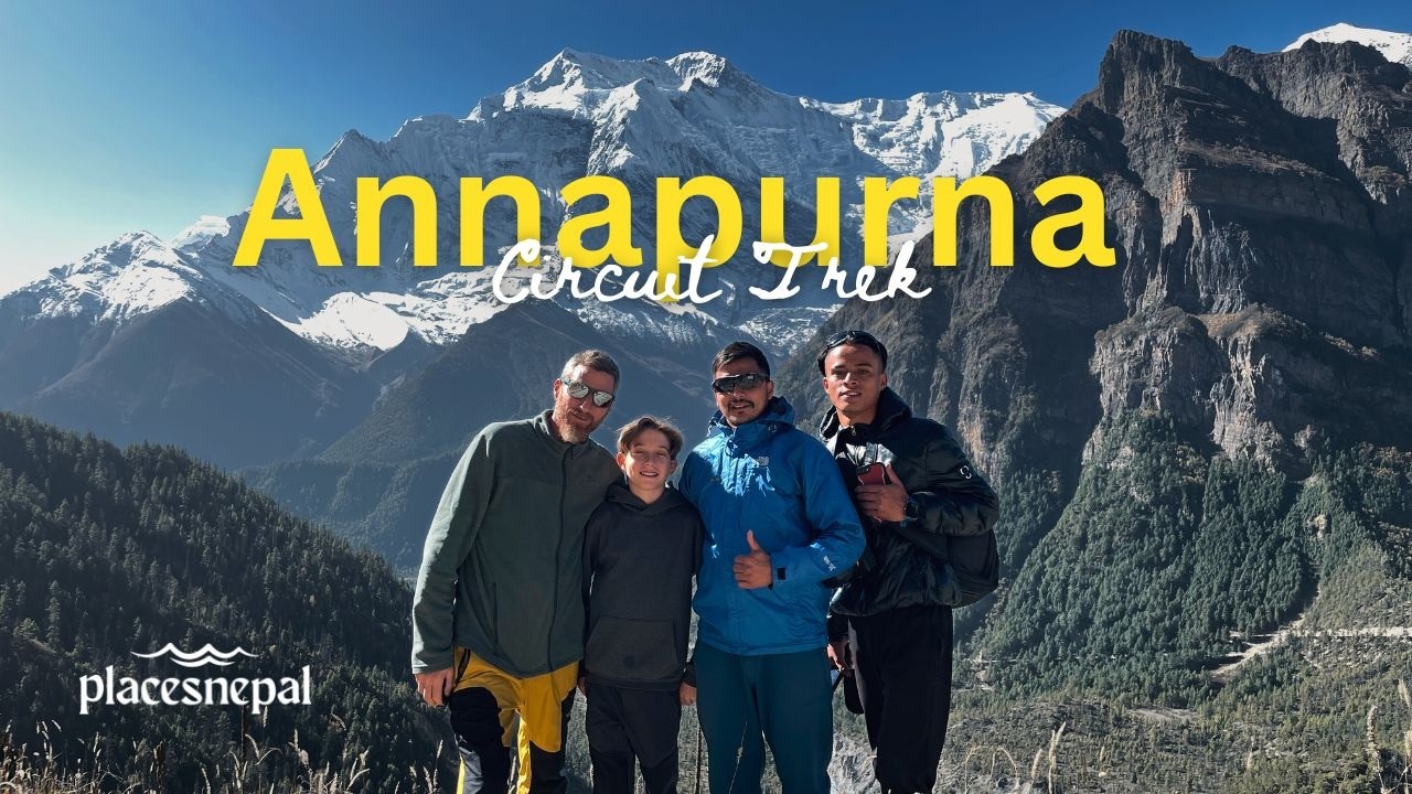
- Annapurna Circuit Trek circles the wider Annapurna massif, giving multiple angles on Machhapuchhre before crossing Thorong La at 5,416 m.
- Everest Base Camp Trek passes directly through Khumbila’s territory around Khumjung and Khunde on the way toward Tengboche and the Khumbu Glacier.
- Kanchenjunga South Base Camp Trek and the longer Kanchenjunga Circuit Trek approach the mountain whose summit tradition — not prohibition — keeps almost every climber a few feet short of the true top.
- Makalu Base Camp Trek runs through the Barun Valley, within reach of several lesser-documented Chamlang and Makalu-area peaks referenced above, though the peaks themselves remain expedition objectives rather than trekking destinations.
None of these treks put you on an unclimbed summit — that's the point. They put you close enough to understand why these mountains have the reputation they do, without requiring a mountaineering permit, a liaison officer, or weeks of technical preparation.
Trekking, Peak Climbing and Expedition Mountaineering Are Different Things
Anyone searching “unclimbed mountains in Nepal” without a mountaineering background is often, without realizing it, asking about one of three very different activities.
| Trekking | Peak Climbing | Expedition Mountaineering |
|---|
| Typical elevation reached | Up to ~5,600 m (passes, viewpoints) | 5,800–6,600 m (NMA trekking peaks) | 6,500 m and above, including all 8,000ers |
| Permit authority | National park / conservation area, TIMS | Nepal Mountaineering Association | Department of Tourism |
| Technical skill required | Fitness and altitude tolerance | Basic crampon/ice-axe use, roped travel | Advanced alpine climbing, route-finding on unclimbed or rarely climbed terrain |
| Guide requirement | Licensed guide required in most regions since 2023 | Licensed climbing guide mandatory | Liaison officer plus high-altitude guides mandatory above ~7,000 m |
| Example | Everest Base Camp Trek | Island Peak Climbing, Mera Peak Climbing | An unclimbed-peak attempt on Anidesh Chuli or Sato Peak |
An unclimbed-mountain attempt sits at the far end of the expedition-mountaineering column. It is not an extension of trekking, and it is a meaningfully bigger step up from peak climbing than the vocabulary suggests.
Can You Climb an Unclimbed Mountain in Nepal?
Yes, provided the peak is on the open list and you meet the requirements — which are considerably heavier than for a standard commercial climb, because there is no established route, no fixed infrastructure, and often no reliable route beta to plan around. At minimum, expect to need:
- A climbing permit from the Department of Tourism (peaks above roughly 6,500m) or the Nepal Mountaineering Association (peaks on its 27-strong trekking-peak list)
- A registered Nepali trekking or expedition agency to submit the application — foreign climbers cannot apply directly
- A liaison officer for expeditions on peaks the government designates as requiring one, typically above 7,000m
- Comprehensive high-altitude insurance, including emergency evacuation coverage rated to the peak's elevation
- A refundable environmental/garbage deposit
- Experienced high-altitude guides or climbing sirdars, and realistically, Sherpa support for route-finding and load-carrying on a mountain with no fixed lines
- A rescue and communications plan, since an unclimbed peak by definition has no history of prior rescues to draw on
- Route planning based on satellite imagery and whatever fragmentary prior-attempt reports exist, since there is no guidebook
Who Issues Mountain Climbing Permits in Nepal?
Two bodies split the work by altitude and peak classification:
- The Department of Tourism, under the Ministry of Culture, Tourism and Civil Aviation, issues expedition permits for peaks generally above 6,500m, including all fourteen of Nepal's 8,000m-class summits (the original eight plus the six subsidiary peaks added to the official registry in 2025).
- The Nepal Mountaineering Association (NMA), a non-governmental alpine club authorized by the government since 1979 to manage this specific function, issues permits for its list of trekking peaks — 27 named summits roughly between 5,500m and 6,584m, split into Group A (more technical) and Group B (more accessible).
For an unclimbed-peak attempt specifically, that almost always means Department of Tourism jurisdiction, since most of the genuinely under-documented objectives (Anidesh Chuli, Chago, Chabuk, Sato Peak, Lumbo Himal) sit above the NMA's altitude ceiling.
For the current fee schedule by altitude band and season, see our detailed Nepal Peak Climbing Permits and Fees guide — permit costs on unclimbed and rarely-attempted peaks generally fall into the same altitude-based fee bands as any other peak of comparable height; there is no separate "first ascent" pricing tier.
How Much Does a First-Ascent Attempt Cost?
There is no standard figure, and any article that quotes one precise number for "climbing an unclimbed mountain in Nepal" is guessing. Costs depend on the peak's altitude band, its remoteness, team size, and season, but the components are consistent:
- Government permit or royalty fee, set by altitude band
- Refundable environmental/garbage deposit
- Liaison officer costs, where a peak's altitude requires one, plus the officer's food, transport and equipment during the expedition
- Domestic transport to the trailhead, which for far-eastern or far-western objectives can mean multiple flights and days of jeep travel before trekking even begins
- Expedition staff: climbing guides, high-altitude support, porters or yaks for the approach
- Base camp and high-camp logistics, food, and fuel for the full expedition window
- Climbing equipment: fixed rope, ice screws, snow and rock protection — all carried in, since none exists on an unclimbed line
- Oxygen, where the altitude and route warrant it
- Satellite communication and weather-forecasting services
- Comprehensive high-altitude insurance, including evacuation
- Contingency days, which matter more on an unclimbed peak than almost anywhere else, since route-finding delays are the norm, not the exception
Places Nepal does not currently organize technical first-ascent expeditions to unclimbed objectives. The peak-climbing trips we run — Island Peak Climbing, Mera Peak Climbing, Lobuche Peak Climbing, and Yala Peak Climbing — are established NMA trekking peaks with known routes, rather than unclimbed-peak attempts. Readers planning a genuine first-ascent expedition should budget through a Department of Tourism-registered expedition specialist and expect costs well above a standard trekking-peak package; we’re not going to fabricate a specific total here.
Best Time to Attempt a First Ascent
- Spring (March–May) is the highest-demand window for Nepal's major peaks generally, with the most stable weather and the highest permit fees to match.
- Autumn (September–November) offers a second reliable window at roughly half of spring's permit cost, with slightly less predictable conditions.
- Winter and monsoon carry the lowest fees but the highest objective risk — extreme cold and wind in winter, heavy snowfall and avalanche danger in the monsoon — and most agencies won't support off-season attempts except for highly experienced teams.
None of this is peak-specific advice. The right season depends on the mountain's aspect, its dominant hazards (a serac-threatened route wants a cold, stable window; a rock-and-mixed route may tolerate more variation), and its exposure to the monsoon, which affects eastern Nepal (Kangchenjunga, Makalu) more heavily and more unpredictably than the central and western ranges.
What Makes a First Ascent So Difficult?
A first ascent removes almost everything that makes a commercial Himalayan climb manageable:
- No established route — every metre of ground has to be assessed and climbed blind, with no prior party's judgment to draw on
- No fixed ropes or known camp sites — camps have to be sited from scratch, often under time pressure, at whatever point the day's climbing runs out
- Unknown snow, ice, and rock conditions — a slope that looks climbable from a distance may turn out to be unstable, overhung, or objectively dangerous only once a team is committed to it
- Full exposure to objective hazard with no historical data on where seracs collapse, where rockfall concentrates, or which slopes avalanche
- Harder retreat decisions — turning back on unknown ground, in deteriorating weather, is a different and often more dangerous problem than descending a known route
- No margin in the weather forecast, since a short window with no established route leaves little room for waiting out a storm partway up
- Logistics built on estimates, not certainty — food, fuel, and rope quantities are all guessed against how long the climb might realistically take, because nobody has done it before to compare against
This is the real distance between an unclimbed-peak attempt and a guided ascent of, say, Island Peak or Ama Dablam — not simply "harder," but a fundamentally different kind of climbing.
Nepal's Mountaineering Story Is Still Being Written
The clearest evidence that Nepal's unclimbed peaks are a live topic, not a historical one: on 22 June 2026, a joint Nepali–American team completed the first recorded ascent of Lumbo Himal (6,250m), in the Ganesh Himal range on the northern edge of the Manaslu Conservation Area, in Dharche Rural Municipality, Gorkha district. The four-person team — IFMGA-certified guide Tul Singh Gurung, Sujal Gurung, Aash Bahadur Gurung, and American climber Eric Mathew Soo, organized through the Himalaya Summit Club — established a base camp at 4,150m and a high camp at 5,049m before summiting via the mountain's southwest face on a route that included sections up to 85 degrees and roughly 400 metres of fixed rope. The peak sits in an unsettled valley with no teahouses or established trekking infrastructure — a genuine expedition-style first ascent, reported by multiple Nepali and international outlets, not a guided commercial climb.
At the same time, near Kangchenjunga, a Korean Alpine Federation team spent April and May 2026 attempting Sato Peak — a mountain whose ascent history is disputed rather than settled, illustrating that "unclimbed" in Nepal today is as often a research problem as a mountaineering one. Between a confirmed new first ascent and a live, unresolved case a few hundred kilometres away, both happening in the same year, this is not a topic that closed a decade ago.
The Ethics of Climbing an Unclimbed Mountain
An unclimbed-peak attempt carries obligations beyond the technical ones:
- Respect sacred and culturally protected mountains absolutely — Machhapuchhre and Khumbila are not loopholes to be worked around; their status reflects decades of consistent local and government position, not an oversight.
- Report first ascents accurately and completely — route taken, dates, team composition, and any sections left unclimbed or bypassed, so the Himalayan Database and future expeditions have something reliable to work from. Sato Peak's decades-long identification confusion exists partly because past teams didn't document precisely enough.
- Acknowledge previous attempts, even failed ones, rather than presenting a route as if no information existed — Anidesh Chuli's 2013 attempt is exactly the kind of prior data a future team should credit and build on, not ignore.
- Manage waste and environmental impact at the same standard expected on commercial peaks, arguably a higher one, since unclimbed objectives sit in areas with no established cleanup infrastructure or precedent.
- Employ and credit local climbing staff properly — the Nepali guides who led the Lumbo Himal ascent are as central to that achievement as the international climber who joined them, and reporting that treats local expertise as secondary misrepresents how these expeditions actually succeed.
How Climate Change Is Changing Himalayan Mountaineering
The Hindu Kush Himalaya region's glaciers are retreating at a documented and accelerating rate: a 2026 assessment from the International Centre for Integrated Mountain Development (ICIMOD) found the region's glaciers are now losing ice at roughly double the rate recorded since 2000, and an earlier ICIMOD study found the 2011–2020 decade saw glacier loss roughly 65% faster than the decade before it. Under a high-emissions scenario, ICIMOD's modelling suggests the region could lose 70–80% of current glacier volume by 2100.
For mountaineering specifically, the practical effects reported across the range include less predictable snow and ice conditions on approach routes, increased rockfall as permafrost that once held terrain together thaws, more unstable seracs, and climbing windows that are shifting and, on some routes, narrowing. These are regional, well-documented trends; this article isn't going to attribute any single unclimbed peak's difficulty to climate change specifically; the point is that conditions on remote, rarely-attempted routes are changing over time in ways that make historical route notes (where they exist at all) progressively less reliable.
Nepal's High Mountains With Places Nepal
Places Nepal is a Kathmandu-based trekking operator, registered with the Nepal Tourism Board and a member of both TAAN and the Nepal Mountaineering Association. We organize guided treks across the regions covered in this article, including Everest Base Camp Trek, Annapurna Base Camp Trek, Annapurna Circuit Trek, Kanchenjunga Circuit Trek, Kanchenjunga South Base Camp Trek, Manaslu Circuit Trek, Langtang Valley Trek, Upper Mustang Trek, Upper Dolpo Circuit Trek, and Makalu Base Camp Trek, among others. We also organize NMA trekking-peak climbs including Island Peak Climbing, Mera Peak Climbing, Lobuche Peak Climbing, and Yala Peak Climbing.
To be direct about the limits of that: we are trekking and trekking-peak specialists, not an expedition-mountaineering outfitter for unclimbed-peak first ascents. A trek to Annapurna Base Camp or Kanchenjunga puts you closer to Machhapuchhre or the peaks around Sato and Anidesh Chuli than almost anything else you could book — but it is a trek, not a route onto an unclimbed summit, and we won't blur that line to sound more capable than we are. If you're planning an actual first-ascent expedition, you'll need a Department of Tourism-registered expedition operator with specific high-altitude technical experience; we're happy to help with the trekking and logistics context around that kind of trip, and to point you toward the right permit information.
Frequently Asked Questions
Are there still unclimbed mountains in Nepal? Yes. Machhapuchhre remains unclimbed for legal and cultural reasons, and Anidesh Chuli remains unclimbed despite a documented 2013 attempt. Beyond named, well-documented cases like these, a wider set of lower-profile peaks — mostly in far-western Nepal — have no confirmed ascent, though for many of them that reflects a lack of any recorded attempt rather than proof of genuine first-ascent difficulty.
What is the most famous unclimbed mountain in Nepal? Machhapuchhre, above Pokhara, by a wide margin — it's visible from the Annapurna Base Camp and Annapurna Circuit treks and has been legally closed to climbing since the early 1960s.
Is Machhapuchhre still unclimbed? Yes. Its only documented attempt, in 1957, stopped roughly 150 feet below the summit, and no permit has been issued since.
Why is Machhapuchhre forbidden? It's regarded as the sacred home of Lord Shiva and holds deep significance for the Gurung community who live in its shadow. The Nepalese government formalized the closure as policy around 1962, and it has held since.
Can you climb an unclimbed mountain in Nepal? On peaks that are officially open (most are), yes, through a Department of Tourism or NMA permit arranged via a registered Nepali agency. On peaks that are legally closed — Machhapuchhre being the clearest case — no permit exists to apply for.
What is a first ascent? The first confirmed successful climb of a mountain to its true summit, by any route.
What is a virgin peak? An informal term for a mountain with no documented ascent at all — accurate only when genuinely no successful climb has been recorded, not simply when a mountain is remote or rarely visited.
What is the difference between an unclimbed and a forbidden mountain? An unclimbed mountain is legally open but has never been successfully summited. A forbidden mountain is legally closed by government decision — usually on religious or cultural grounds — regardless of whether it would be technically climbable.
How many unclimbed peaks are there in Nepal? There's no single reliable count. Nepal has more than 1,300 named peaks and roughly 468 officially classified climbing peaks, but "unclimbed" status for most lower-profile summits reflects an absence of any recorded attempt rather than a verified failed one — treat any precise total with caution.
Which Nepal mountains are open for climbing? The large majority of Nepal's classified peaks — by 2025 figures, roughly 401 of 468 — are officially open, split between Department of Tourism jurisdiction (generally above 6,500m) and the Nepal Mountaineering Association's 27-peak trekking list.
What are Nepal's newly opened peaks? In July 2025, Nepal opened 97 peaks across Karnali and Sudurpaschim provinces royalty-free through the 2026–2027 season, aimed at drawing climbers to the country's least-visited far west.
Are any 8,000-metre mountains in Nepal unclimbed? No. All eight classic 8,000ers, and all six subsidiary summits Nepal added to its official peak profile in 2025, already have documented first ascents, some decades old.
How difficult is an unclimbed mountain to attempt? Significantly harder than a comparable-altitude peak with an established route — there's no fixed rope, no known camp sites, and no reliable prior data on snow, ice, or rockfall conditions.
How much does a first-ascent expedition cost? There's no standard figure; costs scale with altitude, remoteness, and team size, and follow the same government fee bands as any other peak of comparable height — see our Nepal Peak Climbing Permits and Fees guide for current numbers.
What permits are required? A Department of Tourism or NMA climbing permit depending on altitude, arranged through a registered Nepali agency, plus the relevant national park or conservation area entry permit and, above roughly 7,000m, a government liaison officer.
Can trekkers visit areas around unclimbed mountains? Yes — the Annapurna Base Camp Trek and Annapurna Circuit Trek both offer close views of Machhapuchhre, while the Kanchenjunga South Base Camp Trek takes you deep into the Kangchenjunga region, all without requiring a peak-climbing permit.
What is the best season for a first ascent? Spring and autumn offer the most stable conditions generally, but the right window depends on the specific peak's aspect and dominant hazards — there's no single answer that applies to every route.
Are all remote mountains unclimbed? No. Api and Saipal, in one of Nepal's most remote corners, were both climbed by 1963. Remoteness affects how often a peak is attempted, not whether it's already been climbed.
What happens when a mountain gets its first ascent? Its status changes permanently from unclimbed to climbed, regardless of how few people know about it — Lumbo Himal moved from "unclimbed" to "first ascent complete" on 22 June 2026, and Anidesh Chuli will do the same whenever its eventual first successful attempt happens.
Has Nepal had recent first ascents? Yes — Lumbo Himal (6,250m), in the Ganesh Himal range, received its first recorded ascent on 22 June 2026.