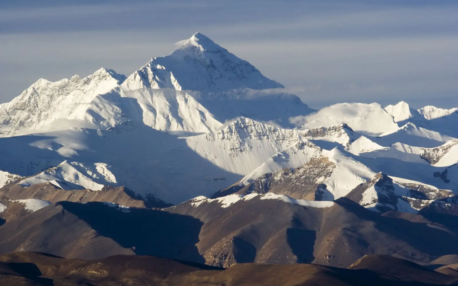
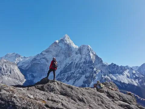
The North Face of Mount Everest presents a greater challenge due to fierce winds, severe weather, limited rescue options beyond Advanced Base Camp, and the notorious Second Step climb.
When people dream of standing face-to-face with Mount Everest, most imagine trekking to Nepal's bustling South Base Camp. But on the other side of the world's tallest peak lies a route less traveled: the Tibet Everest Base Camp (North Base Camp).
Located in the Tibet Autonomous Region of China, this remote destination offers unmatched panoramic views, a deeper connection to Tibetan spirituality, and fewer crowds.
If you're seeking peace, challenge, and awe-inspiring Himalayan scenery, the North Face of Everest delivers a truly unique experience.
In this guide, you'll discover everything about the North Face — from its geography and extreme weather conditions to major climbing routes, historical expeditions by figures like George Mallory, and the cultural significance of sites like the Rongbuk Monastery.
Everest North Face – The Tibet Side of Mount Everest
The North Face of Mount Everest offers a striking and less-crowded alternative to the popular southern route in Nepal. This northern approach is ideal for those seeking a close-up experience with Everest without the long trekking commitment.
North Base Camp: Easy Access Without Trekking
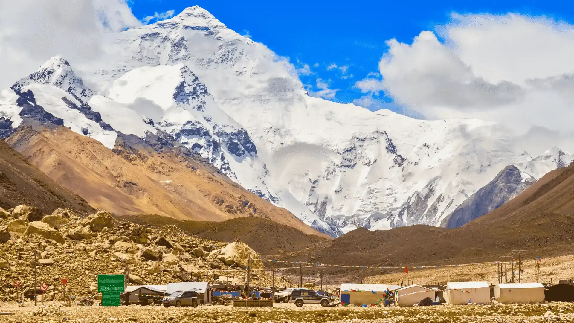
Unlike the South Base Camp, which requires a 10–12 day trek through the Khumbu region, the North Everest Base Camp in Tibet can be reached by road. This makes it a more accessible option, especially for non-climbers or travelers short on time.
The camp sits at an elevation of 5,150 meters, and from here, visitors get an unobstructed view of Everest’s imposing North Face.
Advanced Base Camp in Tibet
For climbers aiming for the summit, the Advanced Base Camp (ABC) lies further up the route at 6,340 meters. It serves as a critical staging point for high-altitude acclimatization and final summit preparations.
For adventure seekers who are not climbing but want to experience high-altitude terrain, visiting ABC is one of the most thrilling and immersive options available.
How to Get to Everest North Base Camp
To reach the North Base Camp, travelers typically:
Fly into Lhasa, the capital of Tibet.
Continue on an overland journey via Gyantse, Shigatse, and Tingri.
The entire trip takes approximately 4 days by vehicle, offering stunning views of the Tibetan Plateau.
The route also includes a stop at Rongbuk Monastery, the highest monastery in the world. From Rongbuk, visitors can either take a shuttle bus or hike for about 90 minutes to reach the base camp.
Why Choose the Tibet Side?
No multi-day trekking required
Ideal for photographers and spiritual travelers
Stunning views of Everest’s dramatic North Face
Access to Rongbuk Monastery and Tibetan culture
Why Do Climbers Choose the North Face to Summit Mount Everest?
Climbing Mount Everest from the North Face in Tibet has become an attractive alternative for many mountaineers due to several key advantages.
1. Lower Climbing Permit Costs
One of the biggest reasons climbers opt for the Tibet side of Everest is the significantly lower permit fees compared to Nepal.
While Nepal’s climbing permits can cost up to $11,000 per person, China offers a more budget-friendly alternative, making the expedition more accessible to climbers with limited funds.
2. Fewer Crowds and Less Congestion
The North Face route sees fewer climbers, resulting in less traffic on the mountain and fewer delays during summit pushes. This reduced congestion also minimizes the risk of bottlenecks at high altitudes, where timing is critical for survival.
3. No Khumbu Icefall Crossing
Unlike the South Face route from Nepal, which requires climbers to traverse the Khumbu Icefall—a deadly section prone to avalanches and collapsing seracs—the North Side route avoids this high-risk zone. This makes the ascent from Tibet a safer option in terms of objective hazards.
4. A More Technical and Remote Climb
While the North Face is often considered more technically demanding, its isolation and rugged terrain attract seasoned climbers looking for a less commercialized and more authentic expedition experience.
North Face vs South Face: Which Route Is Better to Climb Mount Everest?
Choosing between the North Face (Tibet side) and the South Face (Nepal side) of Mount Everest is one of the most common dilemmas for climbers. Both routes offer unique experiences, challenges, and advantages.
South Face (Nepal) – The Popular Choice
The South Face route via Nepal is the most popular and well-established climbing path.
It features well-worn trails, numerous teahouses, and helicopter flight access to Lukla, making logistics and trekking easier.
Permits cost around $15,000, slightly cheaper than the North side despite recent Nepal government regulations.
The route includes the infamous Khumbu Icefall, a dangerous area of unstable ice seracs, but climbing beyond Camp 2 is relatively milder with manageable winds.
The South side tends to be crowded, especially during peak climbing seasons, attracting climbers from around the world.
North Face (Tibet) – The Quiet Challenge
The North Face route is less crowded, with fewer commercial tours and limited facilities such as teahouses.
Access to the North Base Camp requires a long overland journey through Tibet, supported mainly by Chinese military logistics, yaks, and 4WD vehicles.
The climate on the North Face is typically colder and windier, with extreme winds adding a unique challenge compared to the calmer South side.
While the North route avoids avalanche-prone areas like the Khumbu Icefall, it involves more technical climbing near the summit and harsher weather conditions.
Climbers often describe the North Face experience as riskier due to unpredictable dangers and the demanding terrain.
How Difficult Is Climbing Mount Everest from the North Face?
In summary, the North Face of Everest is more difficult due to stronger winds and harsher weather, lack of helicopter rescues beyond Advanced Base Camp, the deadly vertical climb known as the Second Step, longer exposure in the death zone, and a technically demanding route with limited support.
1. Harsher Weather and Stronger Winds
As climbers ascend higher on the Tibetan side, they face increasingly severe winds and sub-zero temperatures. The exposed northern slopes receive colder and more unpredictable weather, making progress extremely difficult and dangerous, especially near the summit.
2. No Helicopter Rescue Above Advanced Base Camp
Rescue operations on the North Face are logistically limited. Helicopter evacuations are nearly impossible above the Advanced Base Camp (6,340 m) due to thin air and restricted airspace. If a climber gets injured or sick beyond this point, self-rescue or help from other climbers becomes the only option.
3. The Second Step: Everest’s Most Dangerous Obstacle
One of the most infamous features of the North route is the Second Step, a nearly vertical rock face located around 8,600 meters (28,200 ft). This section has claimed multiple lives and is considered one of the most technically demanding and deadly parts of the North Face route, even with the assistance of a fixed ladder.
4. Greater Exposure to High Altitude
Compared to the South route, climbers on the North Face spend more time above 8,000 meters, also known as the death zone. Prolonged exposure at these elevations increases the risk of altitude sickness, frostbite, and exhaustion.
5. Technical Climbing and Fewer Support Facilities
The North Face demands strong mountaineering skills, especially in navigating rock, ice, and steep, icy ridges. The route is less commercialized, with fewer Sherpa guides, porters, and logistical support, adding to the climb’s difficulty and requiring climbers to be more self-sufficient.
Everest Geographical Location: Tibet vs. Nepal
The Nepal side (South Face) is popular and trekking-intensive, featuring dramatic landscapes, forests, and avalanche-prone glaciers, while the Tibet side (North Face) is more remote and road-accessible, with a harsher climate and rugged plateau terrain offering a distinct Everest experience.
Everest's Location on the Nepal Side (South Face)
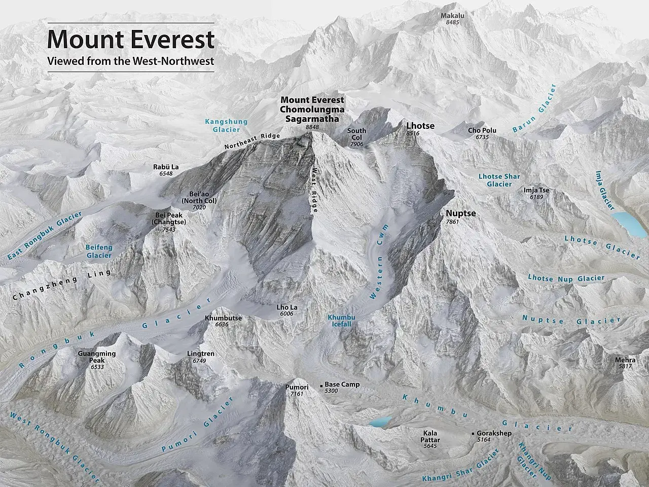
The majority of Everest’s massif lies within Nepal, often referred to as the South Face of the mountain.
The Everest Base Camp (EBC) on the Nepal side is situated at an elevation of 5,364 meters (17,598 feet) in the Mahalangur Sub-Himalayan Range, spanning northeastern Nepal and southern Tibet.
The journey to EBC begins with a flight to Lukla, followed by a trek crossing iconic sites such as Namche Bazaar.
The South Face is characterized by steep, rocky slopes, icy glaciers, and deep valleys, with lower altitudes covered in dense forests transitioning to barren snowy terrain higher up.
This side is prone to avalanches and rockfalls, making climbing both thrilling and risky.
Locally, Everest is called Sagarmatha and lies within Province No. 1, Solukhumbu District of Nepal.
Everest’s Location on the Tibet Side (North Face)
The North Face lies within the Tibetan Autonomous Region of China, specifically in Tingri County, Shigatse Prefecture on the Qinghai-Tibet Plateau — often called the “Roof of the World” due to its extreme elevation.
The Tibet Base Camp sits at a slightly lower altitude of 5,150 meters (16,900 feet) and is accessible primarily by road, without the need for multi-day trekking like on the Nepal side.
The terrain here is notably rugged and harsh, with extreme cold, strong winds, and rough weather conditions that deter many climbers.
Unlike the southern route, the North Face experiences fewer avalanches but is famous for its challenging climbing conditions and wind exposure.
| Feature | South Face (Nepal) | North Face (Tibet) |
| Popularity | Most popular and crowded climbing route, attracts majority of climbers and trekkers | Less crowded, remote, preferred by climbers seeking solitude and a less commercial experience. |
| Accessibility | Requires a 10-12 day trek from Lukla through rugged Khumbu region to reach Base Camp. | Easily accessible by road from Lhasa via Gyantse, Shigatse, Tingri, and then Rongbuk Monastery. No trekking needed to base camp. |
| Base Camp Elevation | 5,364 meters (17,598 feet) | 5,150 meters (16,900 feet) |
| Terrain | Features dramatic landscapes with dense forests, rocky trails, glaciers, and avalanche-prone areas such as Khumbu Icefall. | Characterized by the rugged Qinghai-Tibet Plateau, rocky slopes, icy ridges, and steep cliffs. |
| Weather & Climate | Influenced by Indian monsoon: unpredictable weather with frequent snowfall, rain, and blizzards; slightly warmer temperatures. | Cold and dry climate due to Tibetan plateau; strong winds, low humidity, very cold temperatures year-round. |
| Permit & Cost | Permit fees range from $40,000 to $80,000 depending on season, including government fees, park permits, and support services. | Lower permit fees ranging between $30,000 to $45,000, including climbing permits, environmental fees, and logistics. |
| Technical Difficulty | Includes the dangerous Khumbu Icefall early on; generally less technical climbing above Base Camp but still challenging. | More technical climbing near summit, especially at “Second Step”; harsh winds increase difficulty. |
| Infrastructure | Well-developed trekking trails with numerous teahouses, lodges, and helicopter rescue options available. | Limited facilities with fewer teahouses; helicopter rescue difficult beyond Advanced Base Camp; Chinese military support. |
| Cultural Experience | Rich Sherpa culture with vibrant villages like Namche Bazaar; Buddhist monasteries and traditional festivals. | Tibetan Buddhist culture featuring historic monasteries such as Rongbuk; isolated nomadic communities. |
| Climbing Seasons | Best climbing windows are Spring (April-May) and Autumn (September-November); weather is more predictable in these seasons. | Spring and Autumn are preferred for climbing and trekking; weather is cold but stable during these periods. |
| Rescue & Safety | Helicopter rescue possible from Base Camp and above; well-established support infrastructure. | Helicopter rescue only feasible up to Advanced Base Camp; harsh weather and terrain increase risk. |
| Environmental Factors | Frequent avalanches, rockfalls, and unpredictable monsoon weather increase risk. | Dry climate reduces snowfall but intense winds and extreme cold pose serious threats. |
How to Reach North Everest Base Camp from Nepal
While the North Face of Mount Everest lies in Tibet, many travelers choose to begin their journey from Nepal. There are two primary ways to reach North Everest Base Camp from Kathmandu — by air or overland. Each offers its own balance of comfort, cultural immersion, and adventure.
Option 1: Kathmandu to Lhasa Flight + Overland Drive to Everest Base Camp
This is the fastest and most comfortable route to reach the Tibetan side of Everest.
Step-by-Step Travel Plan:
Fly from Kathmandu to Lhasa
Take a short international flight over the Himalayas, often with views of Everest itself on clear days. You’ll land in Lhasa at an altitude of 3,656 meters.
Acclimatize and Explore Lhasa
Spend at least two days acclimatizing while exploring Tibetan cultural landmarks like:
Potala Palace
Jokhang Temple
Barkhor Street
Begin Overland Journey via Friendship Highway
Travel westward along the Friendship Highway in a private vehicle or group tour. Key stops include:
Gyantse – A historic town with ancient architecture
Shigatse – Home to Tashilhunpo Monastery
Tingri – A quiet mountain town ideal for rest and final acclimatization
Reach Rongbuk Monastery and North Base Camp
From Tingri, travel to Rongbuk Monastery, the highest in the world. From here, take a shuttle bus or walk 90 minutes to reach North Everest Base Camp (5,150 meters).
Why Choose This Route?
Comfortable and well-paced
Excellent acclimatization
Rich cultural experience in Lhasa and surrounding areas
Ideal for non-climbers and photography enthusiasts
Option 2: Overland Journey from Kathmandu via Rasuwagadhi/Kerung Border
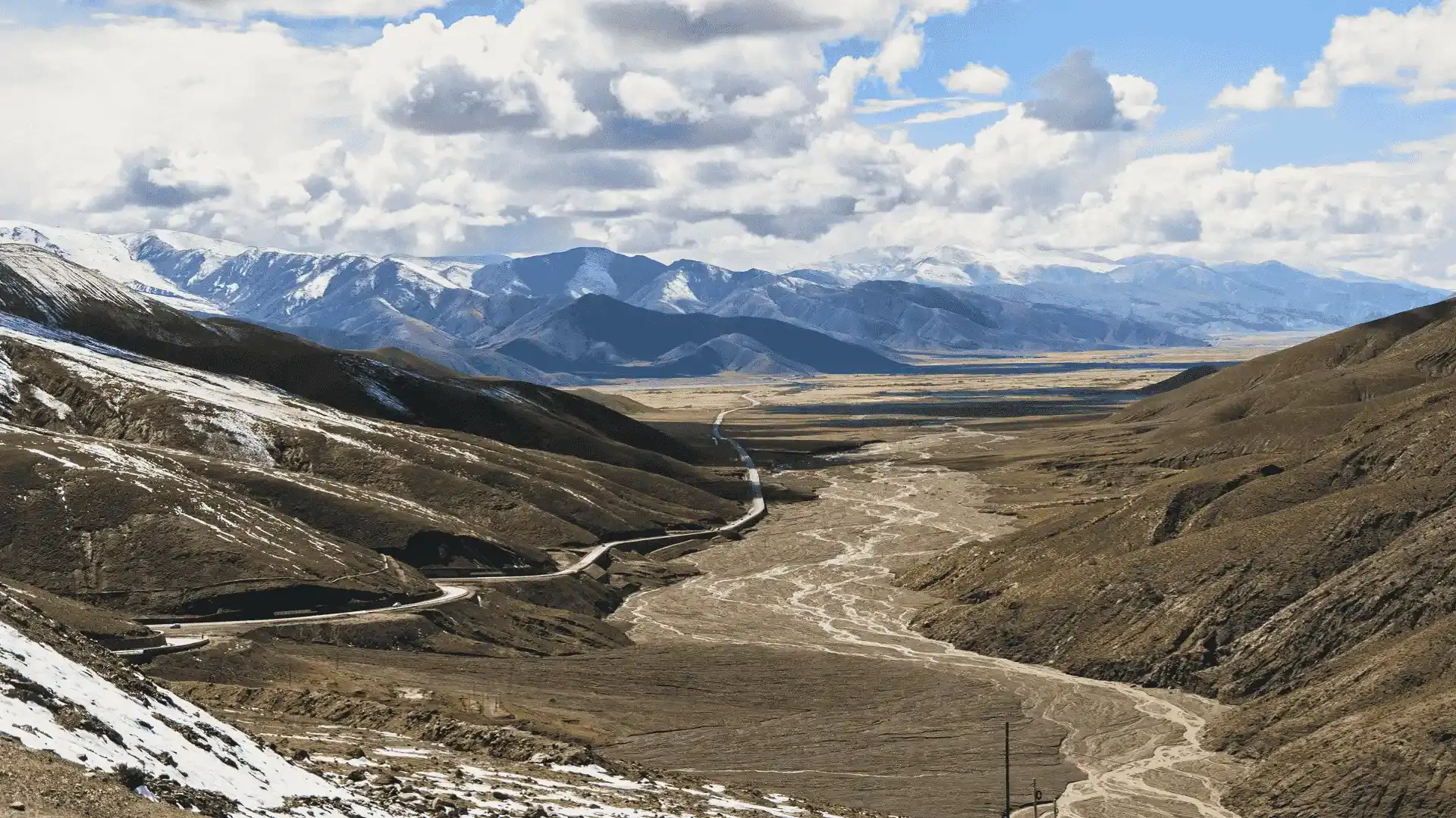
This is a more adventurous, budget-friendly route with deeper cultural encounters and a slower pace for natural acclimatization.
Step-by-Step Travel Plan:
Drive from Kathmandu to Rasuwagadhi Border
A gripping drive through scenic hills, terraced valleys, and remote villages takes you to the Nepal-China border.
Cross into Tibet via Kerung (Gyirong)
After border formalities at Rasuwagadhi, cross the bridge into Kerung (2,700 m) on the Tibetan side. Take time to acclimatize and enjoy local food like thukpa and fresh mountain air.
Continue Overland to Saga and Tingri
Drive through Saga (4,640 m) and eventually reach Tingri, with panoramic views of the Himalayan northern ranges. This slow elevation gain helps prevent altitude sickness.
Reach Rongbuk and North Base Camp
The final stretch leads from Tingri to Rongbuk Monastery and onward to North Everest Base Camp. As the road narrows and prayer flags flutter in the wind, you’ll catch your first full glimpse of Everest’s imposing North Face.
Why Choose This Route?
Deeper cultural immersion
More budget-friendly than the Lhasa route
Natural acclimatization through gradual altitude gain
Unique overland adventure with scenic variety
Geography of the Tibet Side Near Mount Everest
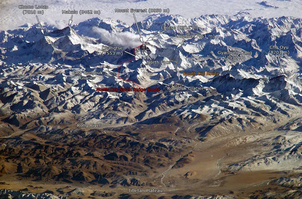
The Tibetan side of Mount Everest lies within the Qomolangma National Nature Preserve, a high-altitude region of vast plateaus, barren valleys, and snow-capped peaks. The terrain is drier and colder than the southern side and features:
Broad open landscapes with fewer settlements
Rocky ridgelines and glaciated zones near Everest’s base
Strong winds due to open exposure
Key locations like Rongbuk Glacier and Rongbuk Monastery
The high elevation of this region — ranging from 4,300 to over 6,000 meters — demands proper acclimatization and careful planning, especially for travelers not used to extreme altitudes.
Everest South Face – The Nepal Side of Mount Everest
The South Face of Mount Everest, located in Nepal, is the most popular and traditional route to summit the world’s highest mountain. This path was made famous by the successful 1953 expedition of Sir Edmund Hillary and Tenzing Norgay, and it remains the preferred route for most climbers today.
Higher Success Rate for Climbers
Climbers attempting Everest from the South Face generally experience a higher success rate compared to the North Face. This is due to more stable weather patterns during the climbing season, better-established infrastructure, and greater support from experienced Sherpa guides and expedition teams.
South Base Camp: Reached Only by Trekking
The Everest Base Camp (South) sits at an elevation of 5,364 meters and requires a 10–12 day trek through the scenic but demanding Khumbu region. This trek not only helps with gradual acclimatization but also allows climbers and trekkers to immerse themselves in Sherpa culture and the stunning landscapes of the Himalayas.
Route to the South Face
The journey to the South Face begins with a dramatic flight from Kathmandu to Lukla, one of the world’s most thrilling airports. From there, trekkers pass through iconic villages like Namche Bazaar, Tengboche, and Lobuche, eventually reaching Everest Base Camp, where summit expeditions begin.
History of the North Face of Mount Everest
The dramatic rise of the North Face of Mount Everest is a story written over millions of years—one shaped by powerful geological forces, ancient oceans, and human ambition.
Around 60 million years ago, the Indian and Eurasian tectonic plates collided with immense force. This ongoing continental crash pushed land upwards and gave birth to the towering Himalayan mountain range, including Mount Everest, the highest point on Earth.
The North Face of Everest, as we know it today, is composed of limestone, shale, and marble—rocks that once rested on the seafloor of the Tethys Ocean. Over millions of years, these oceanic sediments were thrust upward, sculpted by ice, wind, and time into the steep cliffs and icy ridgelines climbers face today.
Climbing Legacy and the Rise of the North Face
In modern mountaineering history, the North Face of Everest has earned a reputation for its technical challenges, isolation, and dangerous conditions. While the South Side in Nepal became the more frequently used route after the first successful ascent in 1953, the Tibet side remains iconic, especially among experienced climbers seeking a more rugged and demanding ascent.
The Death Zone: Everest’s Most Lethal Territory
Above 8,000 meters (26,247 feet) lies the infamous “Death Zone,” where oxygen levels are so low that the human body begins to deteriorate.
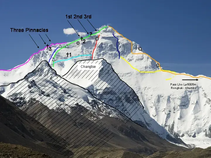
The North Face exposes climbers to longer periods in this high-altitude zone, with colder temperatures and stronger winds due to the face’s open geography. The Second Step, a nearly vertical rock face located at around 8,600 meters, remains one of the most feared features on this route.
First Ascent Attempt of the North Face of Mount Everest
The story of the first ascent attempt on Everest’s North Face is steeped in mystery and enduring legend, centered around two pioneering British climbers: George Herbert Leigh-Mallory and Andrew “Sandy” Irvine.
The 1924 British Expedition
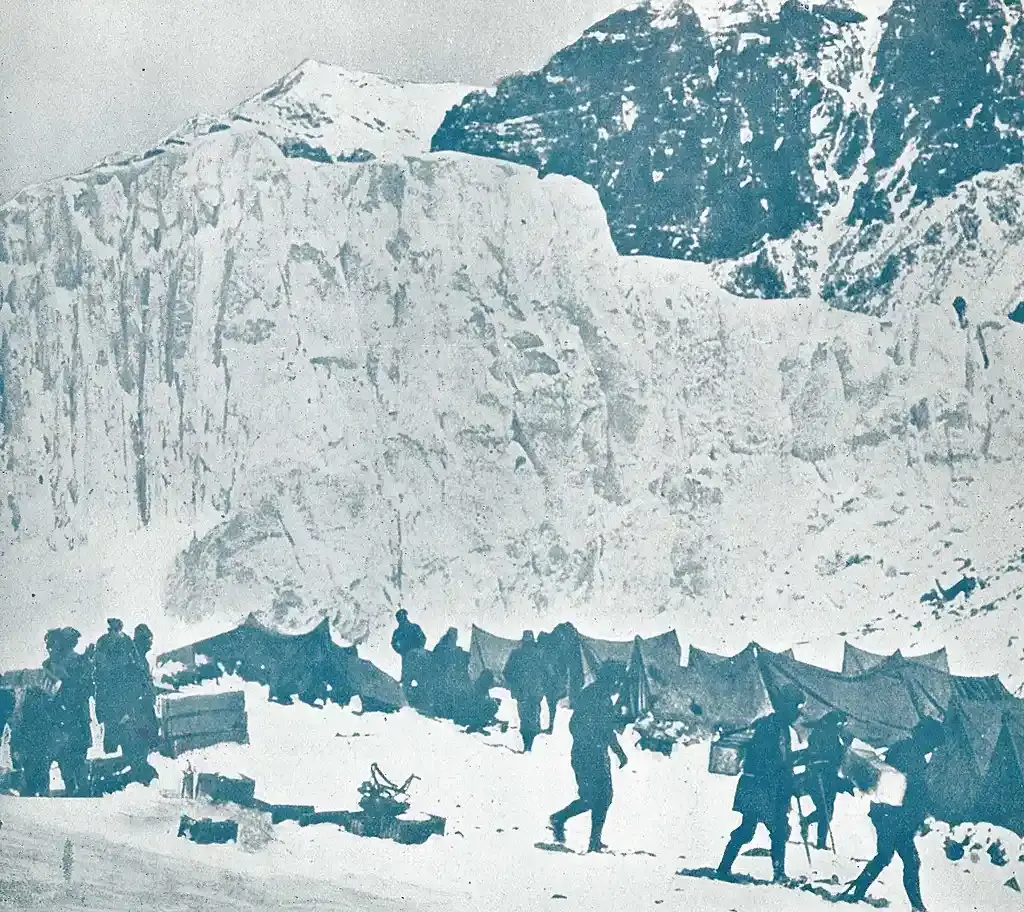
In June 1924, Mallory, a key figure in three early British Everest expeditions, and his climbing partner Irvine made a daring summit push on the North Face. On either June 8 or 9, the pair was last spotted by their team just a few hundred meters below the summit, courageously battling the extreme altitude and harsh conditions.
Their disappearance during the descent sparked one of mountaineering’s greatest mysteries: Did Mallory and Irvine reach Everest’s summit before their untimely deaths? For decades, this question fueled debate among climbers and historians alike.
The Discovery of Mallory’s Body
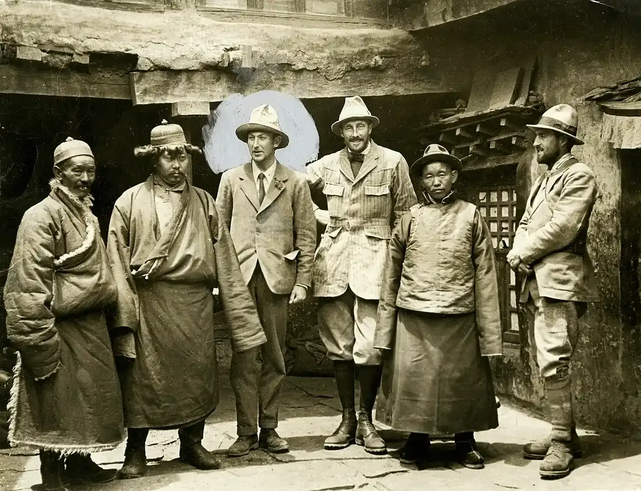
In 1999, the Mallory and Irvine Research Expedition located George Mallory’s remains at approximately 26,760 feet (8,157 meters) on the North Face, near the site of their last sighting.
Alongside his body, several personal items were found, but notably absent was any evidence conclusively proving whether the duo had successfully reached the summit.
How Many Camps Are on the North Face of Mount Everest?
The North Face climbing route on Everest uses six main camps that progressively increase in altitude. Each camp plays a critical role in helping climbers adapt to the thinning air and prepare for the challenging ascent to the summit.
List of Camps on the North Face Route
North Base Camp (5,150 meters)
The starting point for most climbers on the Tibetan side. Unlike the South Base Camp, this camp is accessible by vehicle, making it easier to reach without a long trek.
Advanced Base Camp (6,400 meters)
Located near the Rongbuk Glacier, this camp serves as a key acclimatization and staging area before heading higher up the mountain.
Camp I (North Col) (7,020 meters)
Situated at the North Col, this camp is a vital acclimatization spot where climbers rest before ascending the Northeast Ridge.
Camp II (7,700 meters)
Positioned along the Northeast Ridge, Camp II allows climbers to recover and prepare for the more technical sections ahead.
Camp III (8,200 meters)
Located higher on the ridge, this camp is used for final rest and acclimatization before the push toward the summit.
Camp IV (8,500–8,600 meters)
The highest camp on the North Face route, Camp IV is the last stop before the summit attempt. From here, climbers enter the infamous Death Zone, where oxygen levels are critically low.
Best Time to Visit the North Face of Mount Everest
Spring and autumn provide the best weather and accessibility for trekking and climbing on the North Face, while the summer monsoon brings challenges such as lower visibility and rougher roads, and winter requires advanced preparation due to extreme cold and limited access.
Seasonal Breakdown for Visiting Everest North Face
Spring (April to Early June)
Best season to visit the North Face.
Weather: Stable with clear skies and breathtaking views of Everest’s North Face.
Climbing: Most summit attempts occur in May when temperatures are cold but manageable. The jet stream typically shifts away, reducing high winds.
Trekking: Roads to North Base Camp via Tingri are more accessible, making the approach smoother.
Temperature: Daytime highs can reach around 10°C (50°F) at Base Camp, with nights dropping below freezing.
Summer / Monsoon (Mid-June to August)
Less ideal due to monsoon influences.
Weather: Despite Tibet’s rain shadow effect, occasional clouds and snowfall reduce visibility.
Travel: Road conditions can worsen due to landslides or rain in lower regions, impacting access.
Temperature: Warmer days with temperatures up to 15°C (59°F), but nights remain cold.
Autumn (September to Early November)
Second-best time for visits and trekking.
Weather: Post-monsoon skies are clear and crisp, especially in September and October, offering excellent visibility.
Trekking: Ideal for those trekking to North Base Camp or visiting Rongbuk Monastery.
Photography: Autumn lighting conditions provide sharp, vibrant mountain landscapes.
Climbing: Summit attempts decrease due to colder temperatures and reduced climbing support.
Winter (Late November to March)
Most challenging season for Everest North Face activities.
Weather: Extremely cold with high winds and severe snowfall.
Access: Roads to the Base Camp may be closed due to ice and snow.
Climbing: Rare, as summit wind chills can plunge to −60°C (−76°F), making it deadly.
Trekking: Limited to highly experienced adventurers prepared for extreme isolation and harsh conditions.

